
Prescribed/controlled fire planned for approximately 6,300 acres in the Okanogan-Wenatchee National Forest
information and photo released by USFS
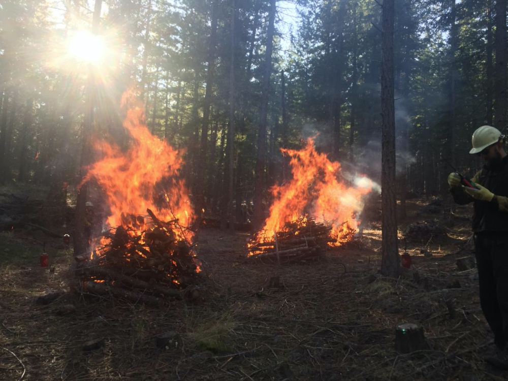
This spring, Forest Service crews plan to use prescribed/controlled fire across approximately 6,300 acres in the Okanogan-Wenatchee National Forest. Prescribed fire projects reduce the quantity of burnable fuels in the forest, improve forest health, better protect nearby communities, and help lower the risk of future high-intensity wildfires. Frequent, low-intensity fire is essential for restoring public lands and the communities who depend on them.
“Prescribed fire and thinning activities could start as early as this week, depending upon local weather conditions, and extend through late May or early June,” said Deputy Fire Staff Officer Matt Castle. “As the snow recedes, we will gain access to our spring prescribed fire units. Although we have thousands of acres planned for treatment this spring, it all depends on fuel and weather conditions whether we will be able to complete all that work or not.”
Burning conditions include correct temperature, wind, fuel moisture, and ventilation for smoke. When these criteria are met, firefighters implement, monitor, and patrol each burn to ensure it meets forest health and public safety goals including air quality. All Okanogan-Wenatchee N.F. prescribed burns are weather dependent and fire specialists will cease burning as soon as possible if objectives are not being met or weather conditions are unfavorable. Their primary concerns include favorable winds that can minimize smoke impacts to public health and the risk of fire escape.
For real-time prescribed fire maps and updates check out the forest website, social media sites, or listen to the day of burn recorded voicemail message:
- Facebook: www.facebook.com/OkaWenNF/
- Twitter: twitter.com/OkaWenNF
- Interactive map: tinyurl.com/harqnw8
- Phone: 509-996-4040
- Lost Driveway unit 1 – 70 acres, located 8 miles northwest of Mazama, WA
- Lost Driveway unit 3 – 40 acres, two and a half miles northwest of Mazama, WA
- Lost Driveway unit 10 – 50 acres, less than a mile west of Mazama, WA
- Lost Driveway unit 15 – 39 acres next to Highway 20 about a mile northwest of Mazama, WA
- Goat Unit 2 – 870 acres located two and a half miles southeast of Mazama, WA
- Crews also plan to ignite approximately 500 acres of debris/hand constructed piles across the Methow Valley Ranger District this spring if conditions allow, starting off with 5 acres of piles on March 29th at the Twisp River Horse Camp area, 19 miles northwest of Twisp, WA and 5 acres of piles on March 30th near Brevicomes, 20 miles north of Winthrop, WA
- Upper Peshastin project area, 350 acres near the top of Blewett Pass, approximately 13 miles southwest of Cashmere in early May
- Moe unit 53 – 53 acres 8 miles west-northwest of Entiat, WA
- FJ unit – 1,412 acres, 12 miles northwest of Entiat, WA
- Crum Canyon unit 23 – up to 100 acres 6 miles northwest of Entiat, WA on March 30th, crews will be igniting the layer of built-up needles (called duff) under trees (in tree wells) to reduce those fuels and lessen the effect of future fires on mature trees in that area
- Falls Coyote units – a total of 553 acres in two units located 19 and 21 miles northwest of Chelan, WA
- Liberty Fuel unit 1 – 100 acres, 13 miles northeast of Cle Elum, WA
- Orion units 4 and 5 – 200 acres, 15 miles northeast of Cle Elum, WA
- Teanaway unit – 500 acres, 13 miles north of Cle Elum, WA
- Canteen underburn unit, 2,000 acres, located 4 miles north of the community of Nile and 14 miles northwest of Naches, WA
Additional prescribed fires and pile burns may be conducted if favorable conditions allow.


