
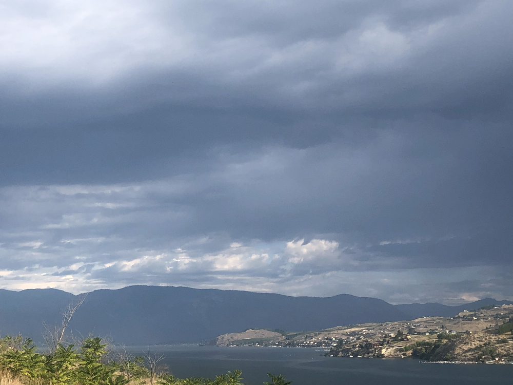
Red Flag Warning in Effect for Critical Fire Weather Conditions
Fire Department Reminder: If you see smoke anywhere, call 9-1-1 immediately!
Scattered Thunderstorms near the Cascades this Morning and Then Across the Columbia Basin this Evening and Overnight
Scattered Thunderstorms Have Developed this Morning Along the East Slopes of the Cascades Ahead of a Cold Front. Storms will Shift to The Columbia Basin During the Evening and Overnight Hours.These Storms will Carry Light to Moderate Rain but with Low Chances for Wetting Rains. Gusty winds will Develop Behind the Cold Front Into Wednesday Morning.
The National Weather Service in Spokane has Issued a Red Flag Warning for Thunderstorms, Which is in effect Until 11pm PDT this Evening.
* Affected Area: Fire Weather Zone 676 East Washington South Central Cascade Valleys (zone 676) and Fire Weather Zone 677 East Washington Central Cascade Valleys (zone 677).
* Thunderstorms: Scattered Thunderstorms (lal 3) capable Of Abundant Lightning and Ignitions this Morning. Isolated Thunderstorms (lal 2) are Possible this Afternoon and Evening.
* Outflow winds: Thunderstorms will be capable of Outflow winds of 40 MPH or Greater. As the Storms Clear East, Gusty winds will Develop with Sustained Speeds of 15 to 25 MPH and Gusts
to 40 MPH.
* Impacts: New Ignitions in the Cured Grasses Could Spread Rapidly from the Combination of Outflow winds Near Thunderstorms and Strong winds Developing with the Trailing Cold Front.
A Red Flag Warning Means That Critical Fire Weather Conditions are Either Occurring Now….or will Shortly. a Combination Of Strong winds…low Relative Humidity…and Warm Temperatures Can Contribute to Extreme Fire Behavior.


