
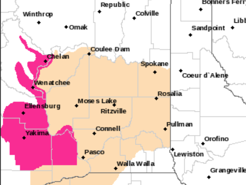
Red Flag Warning in effect from Tuesday afternoon until Wednesday night
Information submitted by National Weather Service. In the graph above, pink indicates areas of Red Flag Warning. Tan indicates areas of Fire Weather Watch.
West winds will increase in Central Washington on Tuesday (June 18) raising concerns of grass and brush fires in the Ellensburg, Vantage, Wenatchee, and Chelan areas.
Wednesday (June 19) will be even windier with widespread sustained winds in the 12 to 18 MPH with gusts to 40 MPH ccross the Columbia Basin, West Plains, And Washington Palouse. Localized Gusts to 50 MPH will be possible around Ellensburg and Wenatchee on Wednesday.
The National Weather Service in Spokane has Issued a Red Flag Warning for Wind and Low Relative Humidity, Which is in Effect from 2pm Tuesday to 9pm PDT Wednesday.
- Affected Area: Fire Weather Zone 677 East Washington Central Cascade Valleys (zone 677).
- Winds: West 12 to 17 MPH with Gusts Up to 35 MPH on Tuesday.Gusts Up to 45 MPH on Wednesday.
- Relative Humidities: 17 to 25 Percent.
- Timing: West winds Gusting As High As 35 MPH are Expected On Tuesday Afternoon and Evening. Gusts Up to 45 MPH will Be Possible on Wednesday.
- Impacts: Gusty West winds and Low Relative Humidities Will Promote Rapid Fire Spread of Existing Fires and Any New Fire Starts.
A Red Flag Warning Means That Critical Fire Weather Conditions are Either Occurring Now….or will shortly. A combination of strong winds…low relative humidity…and warm temperatures can contribute to extreme fire behavior.


