
Containment Increases to 78%
by LakeChelanNow from Incident Command Information; Photos from Inciweb
This story will be updated as new information is received
Previous Cougar Creek Fire information, maps and photos from 8/1/18 – 8/22/18 can be found here

Fire Camp Displays Flags Representative of Fire Fighters from Australia, New Zealand and the US. Photo courtesy of Inciweb.
Cougar Creek Fire Update from Incident Command: 9/10/18
Some firefighters head for home, but suppression repair work continues
Fast Facts:
Acreage: 42,687
Containment: 78 percent
Personnel: 334
Cause: Lightning
Incident Mgt Team: NW Team 10 Lawson (Type 2)
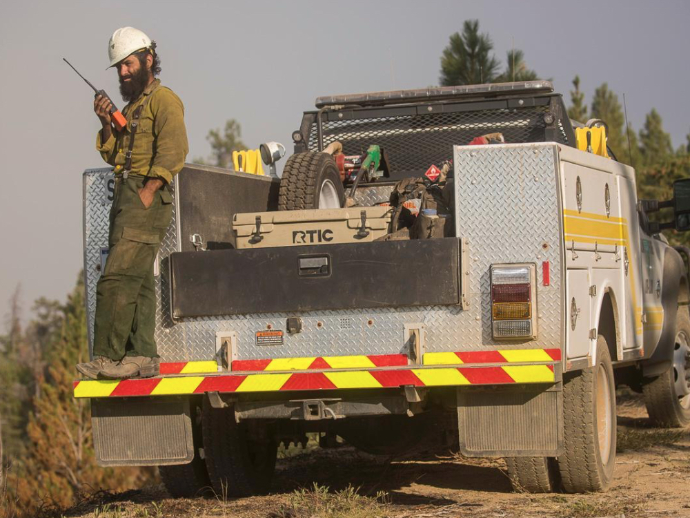
Cougar Creek Fire: Minimal fire activity continues across all divisions of the fire. Some helicopter bucket work was used to cool a small area on the northeast side of the fire Sunday. Fire suppression repair activities continue, including repair of fire lines, dozer lines and roads. Trees and vegetation that were removed in the construction of fire lines are being chipped and piled. This suppression repair work will continue until the work is complete.
The fire is not yet contained as some fire suppression work remains on the north and northeast portions of the fire. However, a smaller force will be able to address this portion of the fire while fire suppression repair continues. Monday the fire organization is releasing some firefighting resources no longer needed. Tuesday Alan Lawson’s Type 2 Incident Management Team will be turning management of the fire over to a smaller Type 3 team made up primarily of local resources.
Lost Fire and Bannock Lakes Fires: These fires show minimal activity and are being monitored by air.
Weather and Fire Behavior: Another cold front will move through the area on Monday bringing blustery winds. This will bring a mix of sun and clouds but generally dry conditions will continue. A few showers may drift across the northern edge of the fire. Low pressure will settle over the area the rest of the week keeping temperatures cool and humidity high. Fire activity should remained subdued but the larger fuels are still dry and will continue to burn, especially if they are open to the winds. Periods of sun and strong winds will dry fine fuels quickly and grassy areas could burn actively with rapid rates of spread.
Restrictions and Closures: Fire use restrictions are still in place. No campfires are permitted. To ensure public and firefighter safety, many road and trail closures remain in effect. Forest visitors are encouraged to call or visit the local Ranger Station or visit the Forest’s Interactive Forest Closure Map found at: https://www.fs.usda.gov/alerts/okawen/alerts-notices. Closures are in effect in the Tommy Creek, Mad River, Upper Mad River, Potato Creek, and Mud Creek areas. The Pacific Crest National Scenic Trail (PCT) also remains closed from Suiattle Pass to High Bridge. The PCT detour is from Suiattle Pass to Stehekin. More information is available at www.pcta.org.
Areas near the Cougar Creek Fire that are open for public use: Fox Creek, Lake Creek, Silver Falls, and Cottonwood campgrounds are open. Shady Pass Road #5900, North Fork Entiat Trailhead, and trails within the Glacier Peak Wilderness area on the Entiat Ranger District are open and accessible. In addition, the Chiwawa River Road, and campgrounds and trails off that road, are open for use.
Cougar Creek Fire Update from Incident Command: 9/8/18
Fast Facts:
Acreage: 42,412
Containment: 73 percent
Personnel: 352
Cause: Lightning
Incident Mgt Team: NW Team 10 Lawson (Type 2)
Cougar Creek, Lost and Bannock Lakes Fires – Scattered rain showers fall across the fires
Cougar Creek Fire: Scattered rain showers fell across the area Friday night. Remote automated weather stations around the fire varied from a one-tenth to one-hundredth of an inch. It was a welcomed relief after the warm temperatures and gusty winds Friday afternoon which caused internal unburned islands and fringes on the north side of the fire to burn aggressively. Because it was determined that the active fire was not threatening to expand the fire perimeter and increasing clouds were damping aggressive burning, no helicopters were used to drop water Friday. There was some lightning in the area and fire crews are poised to respond to any new starts that may reveal themselves Saturday.
It was a productive day on the fire Friday as crews continued to search for and extinguish any hotspots around the contained parts of the fire. Roads and fire lines are being repaired and much of the woody vegetation removed along the roads and contingency lines is being chipped.
The Fish Lake Helibase was closed Friday. If additional helicopter use is requested, aircraft will come from the Central Washington Interagency Coordination Center (CWICC) in Wenatchee.
Lost Fire: The Lost Fire has been held contained at 80 acres. The fire will continue to be monitored by air.
Bannock Lakes Fire: The Bannock Lakes fire remains at 497 acres. This fire is creeping among rocky outcrops and isolated groups of timber in steep, inaccessible terrain. It also is being monitored by air.
Weather and Fire Behavior: Cooler air will flood into the region on Saturday and this will bring gusty west to northwest winds. Wind gusts may reach 25 mph. Temperatures will be 10 to 15 degrees cooler than Friday topping out in the 50s in the mountains and 70s in the valleys. Sunday will be mostly cloudy with a chance for more sprinkles or light rain in the late afternoon or evening.
Restrictions and Closures: Fire use restrictions are still in place. No campfires are permitted. Fox Creek, Lake Creek, Silver Falls, and Cottonwood campgrounds are open. Shady Pass Road #5900, North Fork Entiat Trailhead, and trails within the Glacier Peak Wilderness area on the Entiat Ranger District are open and accessible. In addition, the Chiwawa River Road, and campgrounds and trails off that road, are open for use.
To ensure public and firefighter safety, road and trail closures remain in effect in the Tommy Creek, Mad River, Upper Mad River, Potato Creek, and Mud Creek areas. Visitors to the National Forest are encouraged to call the local ranger station or visit https://www.fs.usda.gov/alerts/okawen/alerts-notices. The Pacific Crest National Scenic Trail (PCT) also remains closed from Suiattle Pass to High Bridge. The PCT detour is from Suiattle Pass to Stehekin. More information is available at www.pcta. org.
Cougar Creek Fire Update from Incident Command: 9/7/18
Cougar Creek, Lost and Bannock Lakes Fires
Smoke expected to decrease and cold front with potential for rain on the way
Cougar Creek Fire: The fire began by smoldering and creeping in the northwest corner of the fire on Thursday morning. In the afternoon, the fire made a run up a ridge south of Jimmy Creek, producing a smoke column visible from Fish Lake to just north of Plain. At this time, there is no concern of major fire movement, but a helicopter will fly over the area this morning to verify conditions. Firefighters patrolled hand line near Signal Peak, and the line continues to hold. Mop up operations, infrared imaging to find hot spots, and patrolling are continuing along completed line on the western perimeter. The southern and eastern areas of the fire are secure, and firefighters are conducting mop up, backhaul, and repair work, such as road grading. The Fish Lake Helibase will close at the end of shift on Friday. Moving forward, air support will be provided out of the Central Washington Interagency Coordination Center (CWICC) in Wenatchee if needed.
Lost Fire: The Lost Fire has been held at 80 acres. Containment lines are complete. The fire will continue to be monitored by air using infrared imagery and aerial reconnaissance.
Bannock Lakes Fire: The Bannock fire remains at 497 acres. This fire is creeping among rocky outcrops and isolated groups of timber in steep, inaccessible terrain. It is being monitored by infrared imagery and aerial reconnaissance.
Weather and Fire Behavior: It was a warm and very dry day across the Central Cascades on Thursday. Warm and dry conditions will continue into Friday ahead of an approaching cold front. Light terrain-driven winds will increase from the south during the afternoon, then switch to the west/northwest with the cold front passage, and become gusty overnight. There is a chance for very light rain showers, and an outside threat for a stray thunderstorm. The majority of smoke in nearby areas is from Okanogan County and British Columbia fires, though the Cougar Creek Fire contributed some smoke Thursday afternoon. Friday will be hazy and smoky in the morning and improve as the day progresses.
Evacuations: All Level 1 “Get Ready” alerts have been lifted.
Restrictions and Closures: Fox Creek, Lake Creek, Silver Falls, and Cottonwood campgrounds are reopened. Shady Pass Road #5900, North Fork Entiat Trailhead, and trails within the Glacier Peak Wilderness area on the Entiat Ranger District will also be open and accessible. In addition, the Chiwawa River Road, and campgrounds and trails off that road, will be open for use.
To ensure public and firefighter safety, road and trail closures remain in effect in the Tommy Creek, Mad River, Upper Mad River, Potato Creek, and Mud Creek areas. Visitors are encouraged to call the local ranger station or visit https://www.fs.usda.gov/alerts/okawen/. The Pacific Crest National Scenic Trail (PCT) also remains closed from Suiattle Pass to High Bridge. The PCT detour is from Suiattle Pass to Stehekin. More information is available at www.pcta. org
Acreage: 42,412
Containment: 71 percent
Personnel: 401
Cause: Lightning
Incident Mgt Team: NW Team 10 Lawson (Type 2)
Cougar Creek Fire Update from Incident Command: 9/5/18
Containment Increases to 71% – Evacuation Lifts and Closure Area is Reduced
Fast Facts:
Acreage: 42,349
Containment: 71 percent
Personnel: 460
Cause: Lightning
Incident Mgt Team: NW Team 10 Lawson (Type 2)
Cougar Creek Fire: All Level 1 “Get Ready” alerts have now been lifted, and closure areas to the northeast of the fire have been reduced. Fire spread was minimal on Tuesday. Helicopters dropped water on active fire areas near Mad River on Tuesday to support containment efforts by firefighters. Fire line near Signal Peak is holding and will be monitored on Wednesday. Containment improved along the western perimeter including the Sugarloaf Peak area, raising the containment to 71 percent. Mop up operations, infrared imaging to find hot spots, and patrolling are continuing along completed line on the western perimeter. The southern and eastern areas of the fire are secure, and firefighters are conducting mop up, backhaul, and repair work.
On Tuesday, smoke returned to the area with air quality ranging from Moderate to Unhealthy. The smoke increase is due to current weather patterns bringing in smoke from Okanogan County and British Columbia wildfires. Smoke from the north is not expected to clear until late Thursday, at which time, smoke may come into the area from wildfires to the south. Air quality is not expected to increase above Moderate anywhere in eastern Washington before Friday.
Lost Fire: The Lost Fire has been held at 80 acres. Containment lines are complete. The fire will continue to be monitored by air using infrared imagery and aerial reconnaissance.
Bannock Lakes Fire: The Bannock fire is now at 497 acres. This fire is creeping among rocky outcrops and isolated groups of timber in steep, inaccessible terrain. It is being monitored by infrared imagery and aerial reconnaissance.
Weather and Fire Behavior: High pressure began to strengthen over the region on Tuesday, promoting light, terrain-driven winds, mild temperatures, and dry conditions. High pressure will remain over Central Washington on Wednesday continuing to support light, terrain-driven winds. Drying will increase, and temperatures will increase by a few degrees.
Evacuations: All Level 1 “Get Ready” alerts have been lifted.
Restrictions and Closures: Fox Creek, Lake Creek, Silver Falls, and Cottonwood campgrounds are reopened. Shady Pass Road #5900, North Fork Entiat Trailhead, and trails within the Glacier Peak Wilderness area on the Entiat Ranger District will also be open and accessible. In addition, the Chiwawa River Road, and campgrounds and trails off that road, will be open for use.
To ensure public and firefighter safety, road and trail closures remain in effect in the Tommy Creek, Mad River, Upper Mad River, Potato Creek, and Mud Creek areas. Forest visitors are encouraged to view the interactive closure map: https://tinyurl.com/yb5zs737. The Pacific Crest National Scenic Trail (PCT) also remains closed from Suiattle Pass to High Bridge. The PCT detour is from Suiattle Pass to Stehekin. More information is available at www.pcta.org.
Cougar Creek Fire Update from Incident Command: 9/4/18
Containment Increases and Repair Work Continues
Fast Facts:
Acreage: 42,134
Containment: 64 percent
Personnel: 519
Cause: Lightning
Incident Mgt Team: NW Team 10 Lawson (Type 2)
The fire saw no increase in size on Monday. Firefighters are constructing containment lines and working to address active fire areas in the north, particularly near Mad River and Signal Peak. Helicopters are dropping water to support on-the-ground efforts. Line has been completed along the western perimeter except for a small area near Sugarloaf Peak, raising the containment to 64 percent. Mop up operations, infrared imaging to find hot spots, and patrolling are continuing along completed line on the western perimeter. The southern and eastern areas of the fire are secure, and firefighters are conducting mop up, backhaul, and repair work.
Team 10 would like to thank the Australian firefighters, the Air National Guard, and the Washington State Guard for their assistance on the Cougar Creek Fire. The Air National Guard and Washington State Guard have been assisting with security and road closures. Most of their service members are approaching the end of their 14-day shift and will be leaving on Wednesday. Their duties will be assumed by the Washington National Guard and additional service members of the Washington State Guard. Australian firefighters will begin their long journey home on Tuesday.

The 2017 Entiat Hotshots are pictured above, courtesy of USFS. LCN has requested a 2018 team photo.
About the Entiat IHC Program
The Entiat Interagency Hotshot Crew is a 20-person wildland fire fighting crew governed by the US Department of Agriculture, US Forest Service, Pacific Northwest Region (R-6). The Entiat IHC is hosted by the Entiat Ranger District located on the north end of the Wenatchee National Forest. Nationally, there are 109 Interagency Hotshot Crews under the jurisdiction of the USDA Forest Service, the US Department of the Interior (USDI) Bureau of Land Management, the USDI National Park Service, and USDI Bureau of Indian Affairs.
Cougar Creek Fire Update from Incident Command: 9/2/18
Little fire growth while suppression efforts continue
Fast Facts:
Acreage: 42,104
Containment: 50 percent
Personnel: 482
Cause: Lightning
Incident Management Team: NW Team 10 Lawson (Type 2)
Public Information Officer, Mike Reichling, indicated they saw some minimal fire activity yesterday on the North and Northwest flanks of the fire. The Entiat Hot Shots have been added to the fire fighting team.
Fire activity has been minimal for the last few days. Firefighters are working hard to build containment lines on the northern portion of the fire. Helicopters are dropping water to support on-the-ground efforts. Containment along the western perimeter from Maverick Peak to Sugarloaf Peak continues with mop up operations, infrared imaging to find hot spots, and patrolling. The southern and eastern areas of the fire are secure and suppression repair work continues on roads and firelines for erosion control.
A remote camp will open in Entiat Sunday for personnel working on the east side of the fire to reduce travel times and the potential for traffic accidents.
Saturday, four crews were sent to assist in initial attack for the Crystal Fire near Pangborn Airport in East Wenatchee. “That’s just what we do – help a neighbor out,” stated Incident Commander Al Lawson.
Cougar Creek Fire Update from Incident Command: 9/1/18
Containment of Cougar Creek Fire Continues as Some Road and Recreation Sites Re-Open
Fast Facts:
Acreage: 41,847
Containment: 50 percent
Personnel: 438
Cause: Lightning
Team: Northwest Team 10 (Type 2)
Cougar Creek Fire: Firefighters continue their efforts to contain the northern portion of the fire by building direct containment lines, widening trails, and dropping water from helicopters. Containment along the western perimeter from Maverick Peak to Sugarloaf Peak is increasing as mop up operations and patrol progress. The southern and eastern areas of the fire are secure where suppression repair work will address erosion control and road repair. A remote camp will open in Entiat on Sunday for personnel working in southern and eastern areas of the fire to reduce travel and potential for traffic accidents.
Lost Fire: The Lost Fire has been held at 80 acres. Containment lines are complete. The fire will continue to be monitored by air using Distributed Real-Time Infrared (DRTI) and air attack aircraft.
Bannock Lakes Fire: Burning in a remote section of the Glacier Peaks Wilderness, the Bannock Lakes Fire is now 492 acres in size. The fire is creeping among large rocky outcrops and isolated clusters of timber in steep, inaccessible terrain. It is being monitored by infrared imagery and aerial reconnaissance. The Pacific Crest National Scenic Trail (PCT) is closed from Suiattle Pass to High Bridge. The PCT detour is from Suiattle Pass to Stehekin. More information is available at www.pcta.org.
Labor Day Weekend: Remember to be patient, well-prepared, and fire safe. Fire danger is extreme. Campfires are banned as is the operation of chainsaws and any equipment that might emit a spark. Do not park in dry grass. Fire equipment will be on the roads in and around the fire area. These vehicles may stop in unexpected locations. Please use caution when fire vehicles are present, the operator may not see you in his or her mirrors.
Weather and Fire Behavior: Gusty northwest winds are expected to continue Saturday morning with speeds of 15 to 25 mph. Winds will weaken into the afternoon hours as temperatures warm into the 60s and 70s. The air mass will remain quite dry with afternoon humidity values drying out into the 20 to 30 percent range.
Evacuations: Effective Monday (08/27/2018), the Chiwawa Loop Road area (including Shugart Flats and Chiwawa River Pines communities) is a Level 1 “Get Ready” alert. The Entiat River Road from Mile Marker 16.5, north to its end is also under a Level 1 alert. For more information, call the Chelan County Emergency Management at 509-667-6863, or visit their Facebook page at www.facebook.com/CCSOEM.
Restrictions and Closures: The Entiat River Road, Chiwawa River Road, and most Forest Service Campgrounds along these roads are now open. All trails connecting with the Chiwawa River Road are open. The Shady Pass Road #5900 is also open. Forest visitors are encouraged to view the interactive closure map: tinyurl.com/yb5zs737.
Phone: 509-664-9210 (8 a.m. to 8 p.m.)
Email: cougarcreekfireinfo2018@gmail.com
Inciweb: https://inciweb.nwcg.gov/incident/6053
Facebook: https://www.facebook.com/cougarcreekfire
Sign up for Daily Updates: https://bit.ly/2sRTpMp
Cougar Creek Fire Update from Incident Command: 8/31/18
Cougar Creek, Lost and Bannock Lakes Fires
Fast Facts:
Acreage: 41,704
Containment: 50 percent
Personnel: 381
Containment of Cougar Creek Fire continues as some road and recreation sites reopen
Cougar Creek Fire:
On Thursday, columns of smoke were again visible from Plain late in the day as drier and warmer conditions caused the fire to become more active within its existing perimeter. Local residents and visitors can expect to see smoke emanating from the interior of the fire until a fire season ending event of rain or snow occurs.
Thursday and Friday, firefighters continue to conduct burn-out operations at portions of the western part of the fire as conditions allow. Although this tactic does produce additional smoke, it is crucial to secure the fire line.
The most active area of the fire is at its northern edge. In this area, crews continue to recon and construct containment lines fire between Signal Peak and Cougar Meadow. This effort is intended to halt the northern progression of the fire and to contain the northeast corner of the fire. Thursday, extensive use of helicopters with water buckets successfully checked the northern spread of the fire. Six helicopters will continue to assist firefighters on the ground as deemed necessary. Mop up of hot spots and patrol of fire lines continues on the eastern, southern, and western perimeters of the fire. Repair of fire containment lines on the eastern and southern sections of the fire progresses.
Fire managers continue to “right-size” the fire-fighting organization as containment advances.
The Entiat River Road, Chiwawa River Road, and all Forest Service Campgrounds along these roads are now open. All trails connecting with the Chiwawa River Road are open. The Shady Pass Road #5900 is also open. Forest visitors are encouraged to view the interactive closure map, located on the Okanogan-Wenatchee NF website before traveling to the national forest. This map shows areas of the national forest that are closed to public use. It is available at tinyurl.com/yb5zs737
Lost Fire:
The Lost Fire has been held at 80 acres. Containment lines are complete. The fire will continue to be monitored by air using Distributed Real-Time Infrared (DRTI) and air attack aircraft.
Bannock Lakes Fire:
Burning in a remote section of the Glacier Peaks Wilderness, the Bannock Lakes Fire is now 489 acres in size. The fire is burning among large rocky outcroppings and isolated clusters of timber in steep, inaccessible terrain. It is being monitored by air and satellite. The Pacific Crest National Scenic Trail (PCT) is closed from Suiattle Pass to High Bridge. The PCT detour is from Suiattle Pass to Stehekin. More information is available at www.pcta.org.
Weather and Fire Behavior:
A high pressure will promote a dry warming trend Friday through Sunday. Afternoon humidity values are expected to drop below 30 percent and overnight humidity recovery will be fair to poor. Winds will continue to be out of the west and southwest on ridgetops and west to northwest through drainages with afternoon gusts of 15 to 25 mph. A cold front is expected to pass through the region late Sunday into Monday bringing gusty winds and some cooling. High temperatures on Friday are expected to be 76-80 degrees at 1500 feet elevation, and 58-62 degrees at 5000 feet.
Traffic Safety:
Fire equipment will be on the roads in and around the fire area. These vehicles may stop in unexpected locations. Please use caution when fire apparatus are present, the operator may not see you in his or her mirrors.
Cougar Creek Fire Evacuation Levels
Plain Area:
Effective Monday (08/27/2018) at 9:00am, the Level 2 evacuation status for all of the Chiwawa Loop Road area (including Shugart Flats and Chiwawa River Pines communities) has been lowered to a Level 1 “fire advisory” status. Areas in Plain and Lake Wenatchee which had been at a Level 1 status, are no longer be under any evacuation notification.
Entiat Area:
That portion of the Mad River Road below the fire area, to the Entiat River Road, and the Entiat River Road from the intersection of the Mad River Road, north to Mile Marker 16.5 is no longer under an evacuation order. The Entiat River Road from Mile Marker 16.5, north to its end is now under a Level 1 Evacuation Alert. The 25 mile per hour speed restriction has been rescinded. For more information, call the Chelan County Emergency Management at 509-667-6863, or visit their Facebook page at www.facebook.com/CCSOEM. An American Red Cross shelter, at 14916 US 97A in Entiat, is on standby. The Red Cross can be contacted at 509-663-3907.
Smoke:
Air quality has been substantially better for the last 72 hours as winds pushed smoke out of the area. However, multiple fires continue to burn across the region and smoke should be expected to return. Individuals with compromised respiratory systems are encouraged to acquire N95 masks. These masks are being provided free of charge, by the Chelan County Sheriff’s Office and are available at local fire stations. For more information on smoke and public health, visit: www.wasmoke.blogspot.com or https://bit.ly/2J22754 (Spanish).
U.S. Forest Service Closure Orders:
The Cougar Creek Fire Area closure remains in effect. However, the entire length of the Entiat River Road is now open to the public as well as all campgrounds within the Entiat River Valley. The Shady Pass Road #5900 is also now open.
Area businesses are open. Please consider showing your support by shopping in the local community.
Incident Management Team:
Northwest Team 10 (Type 2) continues to work closely with cooperators from the US Forest Service, Washington Department of Natural Resources, Entiat Rural Fire District 8, Chelan County Fire District 3, Peshastin Rural District 6, Lake Wenatchee Fire and Rescue, Chelan County Sheriff’s Office, Chelan County Department of Emergency Management, Chelan County Public Utility Dept., Washington Department of Transportation, American Red Cross, Chelan Public Schools, and Chelan Public Works. 19 Firefighters from Australia are supporting.
Fire Information:
Phone: 509-664-9210 (8 a.m. to 8 p.m.)
Email: cougarcreekfireinfo2018@gmail.com
Inciweb: inciweb.nwcg.gov/incident/6053
Facebook: facebook.com/CougarCreekFire #WaWildfire #CougarCreekFire
Interactive Evacuation Map: https://bit.ly/2MnFB9j
Cougar Creek Fire Update from Incident Command: 8/30/18
Increased Smoke the Result of “Interior Island” Burning
Public Information Officer, Jacob Welsh indicated that Wednesday’s increased fire activity and the resulting smoke was reflective of a wind driven “Interior Island” fire. This terminology refers to unburned pockets of timber and fuel located within the existing fire perimeter.
The increased smoke and visibility of fire activity from many public locations, along with dramatic fly-over footage and images of interior fire pockets may have caused concern, however, the fire did not grow substantially.
The fire now stands at 41,589 acres, which includes an increase of 159 acres yesterday. The fire is still at 45% containment.
Welsh indicated that “taking everything into account, overall things look solid, however the north end of the fire needs work”. He was referring to the slight increase of fire activity on the north flank of the fire where no containment lines exist. Welsh stated this is due to rugged terrain that does not allow for safe accessibility for firefighting personnel.
Goals today include holding what they have and mopping up on the west flank, monitoring the north side of the fire, and removing equipment no longer needed. Fire weather should be a bit cooler today with higher humidity and no red flag warnings.
Today is the first official day of Northwest Incident Management Team #10, led by Incident Commander Al Lawson.
Cougar Creek Fire Update from Incident Command: 8/29/18
Red Flag Warning Issued for Wednesday Afternoon
Fast Facts:
Acreage: 41,430 acres (minimal growth)
Containment: 45% (same)
Personnel: 458
Recap: Tuesday was a good day on the fire with little growth and an opportunity to perform rehab work on the east side of the fire.
Today: Red Flag wind warnings are in effect from 1pm to 6pm. 4 helicopters are available for Aviation support. Firefighting crews will be concentrating on west side of fire today. The new Incident Command Team led by Al Lawson of Team 10 will take over this evening at 6 p.m.
Cougar Creek Fire Update from Incident Command: 8/28/18
Containment at 45%
Fast Facts:
Acreage: 41,376. (small growth over the past week – mostly due to firing operations)
Personnel: 526 (down about 50% from peak)
Goals: Fire crews will continue to build on the success of past few days, note evacuation levels are being reduced from Level 2 to Level 1
This week will be doing a team transition on Wednesday as Team 10, a Type 2 team takes over
Other: Aviation resources available today if needed.
Acreage: 41,376
Containment: 45 percent
Personnel: 526
Evacuation Levels Decrease Around Plain
Incident Management Team Right Sizes Operation
Evacuation levels were reduced yesterday west of the Cougar Creek Fire. Chiwawa Loop Road area (including Shugart Flats and Chiwawa River Pines communities) is now at a Level 1 and evacuation levels have been completely lifted for those areas west of the fire that were already at Level 1.
Fire behavior was moderated yesterday due to higher humidity, some single tree torching occurred well within the fire perimeter and smoke was visible in the Grandma Creek area. Patrolling and securing fire line around southern and eastern edges continues and firefighters are addressing suppression repair and rehabilitation needs along roads. Line construction has progressed along the fire’s north western edge, tying together sections of line in the most rugged terrain. Crews are locating and extinguishing hot spots on, and adjacent to, the fire perimeter. They are working on the alternate fireline in the Mosquito ridge area and, if conditions allow, may conduct a burnout operation near Burgess Cabin to secure that fire edge.
Weather and Fire Behavior:
The forecast over the next two days calls for a slight increase in temperatures along with slight decrease in relative humidity, creating conditions for more active fire behavior. This change in weather can be considered “a double edge sword”, causing an increase in fire activity on areas of the fire still unsecured, while also allowing firefighters to make a more secure line with successful burnout operations on the fire’s west side. Tomorrow will bring the possibility of Red Flag warning for higher winds, and the potential for increased fire growth along edges not yet contained.
Traffic Safety:
Fire equipment will be on the roads in and around the fire area. These vehicles may stop in unexpected locations. Please use caution when fire apparatus are present, the operator may not see you in his/her mirrors.
Cougar Creek Fire Evacuation Levels
Plain Area: The Chiwawa Loop Road area (including Shugart Flats and Chiwawa River Pines communities) has been lowered to a Level 1 “fire advisory” status. Areas in Plain and Lake Wenatchee are no longer under an evacuation notification.
Entiat Area: The Entiat River Road from Mile Marker 16.5, north to its end is now under a Level 1 Evacuation Alert.
For more information, call the Chelan County Emergency Management at 509-667-6863, or visit their Facebook page at www.facebook.com/CCSOEM. An American Red Cross shelter, at 14916 US 97A in Entiat, is on standby. The Red Cross can be contacted at 509-663-3907.
Smoke:
Smoke conditions over the fire area and the region have improved significantly. Although the breath of fresh air has been most welcome, we can expect to see smoke increasing over the area as fire behavior picks up across the Pacific Northwest due to warming temperatures and decreased humidity levels.
Cougar Creek Fire Update from Incident Command: 8/27/18
Fast Facts:
Acreage: 41,324
Containment: 45 percent
Personnel: 762
Evacuation Levels Decrease Around Plain – Incident Management Team Right Sizes Operation
Chelan County Fire District 9, the Chelan County Sheriff’s office and the Incident Management Team have evaluated the current evacuation levels in place for the Chiwawa Loop Road community near Plain. The fire threat to residents has diminished significantly over the past two days due to the construction of a solid fire line along much of the western edge of the fire. Effective Monday (08/27/2018) at 9:00am, the Level 2 evacuation status for all of the Chiwawa Loop Road area (including Shugart Flats and Chiwawa River Pines communities) will be lowered to a Level 1 “fire advisory” status. Areas in Plain and Lake Wenatchee which have been at a Level 1 status, will no longer be under any evacuation notification. Residents are asked to continue to monitor fire information daily, should conditions change.
Precipitation on the fire yesterday was light, with only a few hundredths of an inch of rain recorded. However relative humidity remained high throughout the day and greatly diminished fire behavior. Smoldering was observed as heavy fuels in the interior continue to be consumed.
Crews proceeded with mop up, working through the ash to locate and extinguish hot spots. Smoldering branches and logs were moved into the interior. On the eastern and southern flanks of the fire, firefighters cold-trailed the line. In this process, firefighters will search for concealed heat sources, sometimes removing one glove and holding their hand over the ash to feel for heat.
As containment increases and the risk to the surrounding communities lessens, incident management team begins “right sizing” the operation. Firefighters and equipment are being released from Cougar Creek to help with other incidents across the region. The remote base in Entiat has been closed and resources stationed there have either been released or relocated to the Leavenworth camp.
Cougar Creek Fire Update from Incident Command: 8/26/18
Favorable weather continues to benefit firefighting operations
Yesterday was a very productive day, and crews on the night shift continued that good work into night. The incident is staffed with 946 firefighters and support staff, including the Entiat and Prineville Interagency Hotshot crews. Hotshots are some of the most highly trained wildland fire crews available. Their skills have helped to make the complex burn operations executed on the Cougar Creek Fire successful.
Yesterday crews advanced burn operations along the western perimeter to protect private property in Plain and the Chiwawa Pines area. Results from last night’s infrared flight indicate only scattered heat on the southern and eastern sides of the fire. Crews will continue to mop-up and monitor the fire-line. Assessment of structures in the communities of Chiwawa Pines, Shugart Flats and Plain will continue. Assessment of structures in the upper Entiat River Valley will be completed today.
Higher relative humidity and lower temperatures moderated fire behavior on Cougar Creek. Growth was modest. The fire is currently 41,324 acres. Much of the increase in acreage is attributed to burning operations along the perimeter.
Cougar Creek Fire Update from Incident Command: 8/25/18
Officials Report Good Progress Over the Past 24-hours
Public Information Officer Mike Reichling reported good progress yesterday and last night. The acreage grew slightly to 41,324 acres, however, Reichling indicated that is a result of aggressive and very successful firing operations. Favorable winds helped by sending the firing operation efforts back into the primary fire which helps reinforce the containment lines. Containment remains at 40% with a strong eastern line and increased lines along the Chiwawa Loop.
Although tankers had been anticipated as part of Friday’s aerial support, Reichling told us the helicopters are extremely precise and weather conditions allowed them to continue air operations throughout the day. 3 Type 3 Helicopters and 6 Type 1 Helicopters will be in operation today as well.
Saturday’s weather report calls for an increase in moisture. Reichling indicated it wouldn’t be wet enough for fire suppression, but the moisture could slow down fire behavior. On the flip side, the same weather might slow down the firing operations. “It’s a process of taking what you are given and do the best you can with it,” stated Reichling.
There will be a transitioning of personnel throughout the week as teams move out for R&R or redeployment and are replaced by other teams. Much of the Entiat fire camp personnel will be relocated to the Leavenworth camp.
Reichling was pleased to report a change in evacuation levels for the Entiat Valley. All level 2’s are being reduced to level 1, and the normal speed limits are back in force “just in time for school.”
Cougar Creek Fire Update from Incident Command: 8/24/18
Burning operations continue on the west flank of the fire. Heavy air tankers may be flown today.
Fast Facts:
- Acreage: 40,388
- Containment: 40 percent
- Personnel: 907
Yesterday, crews working on the western flank of the fire near Chiwawa Pines made good progress. With support from helicopters, firefighters executed burn operations, pushing low intensity fire back toward the main fire front. This process removes ground fuels without harming mature trees. When the main fire reaches the pre-burned area, there is no fuel remaining, and the fire’s progress is halted. Today burning operations will continue on the west side. Hand crews and heavy equipment will build and secure containment lines to protect private property in the Chiwawa Pines and Plain areas. If weather conditions support the mission, fixed wing air tankers may be used today to place lines of fire retardant outside the western flank of the fire. This retardant will serve as an additional barrier to prevent spot fires from becoming established.
Along the southern and eastern sides of the fire, crews continue to mop-up and monitor the fire-line. Assessment of structures in the communities of Chiwawa Pines, Shugart Flats and Plain will continue today. Dozers and other heavy equipment are working to construct secondary containment lines above the communities. Assessment of structures in the upper Entiat River Valley will also continue, and crews will scout the area to identify locations for additional contingency lines as a precaution.
Although active fire behavior was observed yesterday on Cougar Creek, firefighters have been successful in keeping the fire with in containment lines and growth has been minimal. The fire is currently 40,388 acres. The majority of growth in acreage is attributed to burning operations along the perimeter.
This video animation depicts approximate fire location and terrain.
DISCLAIMER: This video graphic shows an approximate perspective of fire activity and the topography of fire location and terrain. It is not an official rendition, and fire incident management have pointed out there are several locater inaccuracies. However, creator Kanji Kato, has provided a dramatic viewpoint that demonstrates the geographical elements firefighters must battle so we are presenting it as an animation example of the general fire vicinity.
Official information, maps, images and videos come directly from incident command.
Update on Cougar Creek Fire
Thursday, August 23, 2018
Fast Facts:
Acreage: 40,105
Containment: 40 percent
Personnel: 1008
Community Meeting TODAY in Entiat Chelan County Fire District #8, Station #1
(2200 Entiat Way) at 6:00 p.m.
Cougar Creek Fire: A Red Flag warning is in effect today across the fire area. This means that firefighters can expect a combination of winds, low humidity and warm temperatures. Yesterday, crews were able to begin low intensity burnout operations along the western edge of the fire, strengthening the primary containment line. Smoke lifted again which provided opportunities for aircraft to support firefighters on the ground using both water and retardant. Helicopters were able to drop over 280,000 gallons of water once the smoke lifted.
When conditions allow, crews will continue the low intensity burnout operations along the western edge of the fire. Along the southern and eastern sides of the fire, crews continue to mop-up and monitor the fire-line. Crews will continue to assess structures in the communities of Chiwawa Pines, Shugart Flats and Plain while also continuing to use dozers and other heavy equipment to prepare the secondary containment line above the communities. Structures in the upper Entiat River Valley will also continue to be assessed and additional contingency lines are being identified as a precaution.


