
High winds and thunderstorms forecast today
information released by National Weather Service
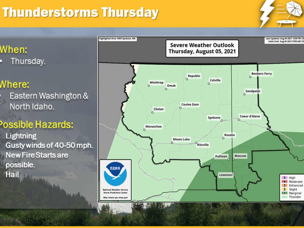
A growing risk of thunderstorms is expected across Central and Eastern Washington and North Idaho on Thursday, August 5. Some of the storms could be strong and produce locally damaging winds, hail, and produce cloud-to-ground lightning strikes that may ignite new fires.
Red Flag Warning…BREEZY WINDS AND THUNDERSTORMS TODAY… Scattered showers and thunderstorms with little precipitation could produce scattered lightning and generate gusty outflow winds this afternoon and evening across the portions of the Columbia Basin, Washington Palouse, and Spokane Area.
In addition…breezy to windy conditions coupled with low relative humidities will lead to fire weather concerns for the central WA Cascade gaps and over a portion of the Okanogan Valley.
…RED FLAG WARNING REMAINS IN EFFECT FROM 11 AM THIS MORNING TO 11 PM PDT THIS EVENING FOR THUNDERSTORMS FOR THE COLUMBIA BASIN PALOUSE AND SPOKANE AREA…
* Affected Area: Fire Weather Zone 673 East Washington Northern Columbia Basin (Zone 673) and Fire Weather Zone 674 East Washington Palouse and Spokane Area (Zone 674).
* Thunderstorms: Scattered thunderstorms with lightning and little precipitation.
* Outflow Winds: Winds 15 to 25 mph with gusts 40 to 45 mph possible. * Impacts: Hot and dry conditions preceding the thunderstorms will result in elevated fire conditions. The addition of scattered thunderstorms with lightning and very little precipitation may lead to increased fire starts and fire spreads.
PRECAUTIONARY/PREPAREDNESS ACTIONS… A Red Flag Warning means that critical fire weather conditions are either occurring now….or will shortly. A combination of strong winds…low relative humidity…and warm temperatures can contribute to extreme fire behavior.
For additional information, visit the National Weather Service website.


