
Enter your address for timely updates to emergency evacuations
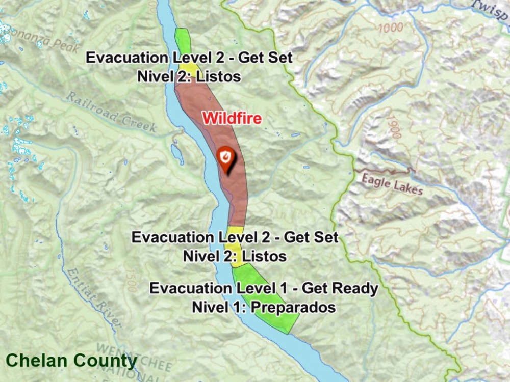
information released, image shows Pioneer Fire evacuation areas
With our first major wildfire now underway in Chelan County, we have to ask, how many of you know about the Chelan County Emergency Incidents Map?
The online map was created in 2021 by a GIS technician in Chelan County Public Works who saw a need to give the public a timely update to emergency evacuations in a more visual way, taking out the confusion of whether someone’s home is in an evacuation area or not. Today, the map is maintained by Emergency Management and RiverCom.
The map provides consistent, real-time updates of road closures, evacuations and structure counts that are essential during wildfire season.
It allows homeowners to put in their address and see if their property is in an evacuation area, and what level of evacuation they are on. it is in both English and Spanish.
For emergency responders, the online map also gives them an accurate number of how many structures and homes are in an evacuation area – and where those homes are.
It’s a great tool that anyone can use — and rely on if you have a wildfire in your area.
Watch a video we did last year on the Emergency Incident Map. It’s creator, Lori Beidler, formerly of Public Works, now maintains the map for Rivercom.


