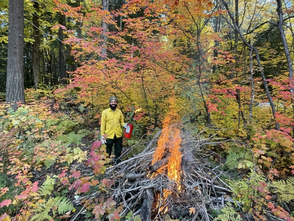
“Prescribed fire is one of our most effective tools for reducing wildfire risk and improving forest health”information released The U.S. Department of Agriculture’s Forest Service and Environmental Protection Agency, in partnership with the Washington State Department of Health, Department of Natural Resources, and Department of Fish & Wildlife, are working along with other federal, state, local, and tribal partners to expand collaborative work in Central Washington. These efforts aim to increase prescribed fire, reduce wildfire risk, and strengthen public health protections from smoke. This expansion builds on the Pacific Northwest prescribed fire and smoke management collaboration launched in 2024 and advances the Central Washington pilot focused on the Okanogan-Wenatchee National Forest and nearby state-managed lands and communities. “Prescribed fire is one of our most effective tools for reducing wildfire risk and improving forest health. By using our best management practices, the burns produce fewer smoke impacts than wildfires and help make our landscapes more resilient,” said Jacque Buchanan, regional forester for the Forest Service Pacific Northwest Region. “This expanded collaboration in Central Washington shows what we can accomplish together. With our federal and state partners and Tribal nations, we’re committed to carrying this work forward and building a safer, healthier future for communities across the Pacific Northwest.” Agency partners are using an incident command structure to coordinate planning, outreach, air-quality monitoring and public health protections as they work toward multi-jurisdictional prescribed burns in fall 2026 and spring 2027. Pilot implementation began last fall and spring in Kittitas and Chelan counties, and will continue there this season, as well as expanding into western Okanogan County and Yakima County. “Across the Pacific Northwest, communities are already seeing the impacts of a longer, smokier wildfire season,” said Emma Pokon, regional administrator for the Environmental Protection Agency. “Prescribed fire is one of the tools state and federal landowners have to reduce hazardous fuels and support healthier, more resilient forests. EPA is proud to support the lead federal, state, and local agencies as they make science-informed decisions and proactively communicate with stakeholder groups so people can make informed decisions about their health as it relates to air quality.” The Central Washington pilot is designed around five core principles: act with urgency; protect public health, safety and property; identify and overcome barriers to implementing prescribed fire at scale; use innovative, comprehensive best practices; and learn from experience and adapt. Project objectives include: |
- Strengthening interagency coordination and cross-region learning.
- Developing and implementing a communications plan to reach potentially impacted communities early and often.
- Coordinating air-quality monitoring and forecasting to evaluate smoke impacts and model performance.
- Ensuring communities have advance notice, health information and access to exposure-reduction resources.
- Increasing the pace and scale of prescribed fire through innovative smoke-management practices.
- Supporting research and after-action review to capture lessons learned and improve future efforts.

Partners will also coordinate outreach to vulnerable populations, identify communities likely to be affected by burns, and share information on prescribed fire, smoke impacts and tools such as clean air resources and N95 respirators.
The collaborative effort includes federal, Tribal, state and local agencies and is intended to improve the scale and effectiveness of prescribed fire while minimizing smoke impacts and protecting public health. Support from the Environmental Protection Agency and its partners has aligned land management and air-quality goals in response to worsening wildfire conditions across the Pacific Northwest.
Please visit our websites for additional information:
Okanogan-Wenatchee NF- Forest Service planned Prescribed burns interactive map: and weekly planned burn activity: https://www.fs.usda.gov/r06/okanogan-wenatchee/fire/management
WADNR and WDOH- https://dnr.wa.gov/sites/default/files/2026-10/rp_central_wa_smoke_pilot_flyer_1026.pdf
Smoke Pilot Interactive map web: https://experience.arcgis.com/experience/4cdd6c2f307b467593c185d6b30da58f