
Visit WSDOT.WA.GOV for real-time travel conditions
information released
A Winter Weather Advisory remains in effect from 10:00 a.m. on Thursday to 3:00 p.m. Friday.
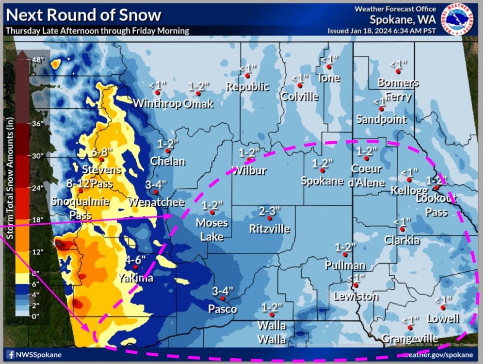
Light snow will develop late Thursday afternoon across central Washington and spread into eastern Washington and north Idaho Thursday night. By Friday morning, expect widespread 1 to 3 inch accumulations with local amounts of 6 to 10 inches in the Cascade Mountains.
Snow will see a transition to sleet or freezing rain over the Columbia Basin into the southern to central Idaho Panhandle.
- WHAT…Mixed precipitation expected. Total snow accumulations between 5 and 9 inches and ice accumulations around a light glaze.
- WHERE…Holden Village, Stehekin, Plain, Stevens Pass, and Leavenworth.
- WHEN…From 10:00 a.m. Thursday to 3:00 p.m. Friday.
- IMPACTS…Travel could be difficult. The hazardous conditions could impact the Thursday evening and Friday morning commutes.
- ADDITIONAL DETAILS…Precipitation will start as snow Thursday mixing with freezing rain near Stevens Pass Friday morning.
PRECAUTIONARY/PREPAREDNESS ACTIONS… Slow down and use caution while traveling. For the latest travel information in Washington, go to https://wsdot.wa.gov/travel


