Crews will use controlled fire across Okanogan-Wenatchee National Forest
information released, photo credit U.S. Forest Service by Jason Emhoff
It is that time of year when the Okanogan-Wenatchee National Forest is getting ready to start fall prescribed fire projects. Forest Service crews plan to use controlled fire across 12,129 acres in the national forest this fall if conditions and weather allow. Burning may begin as soon as this week and continue through the winter if burn piles are accessible. Smoke will be visible from a variety of places throughout the forest depending on the location of the burn units and weather conditions.
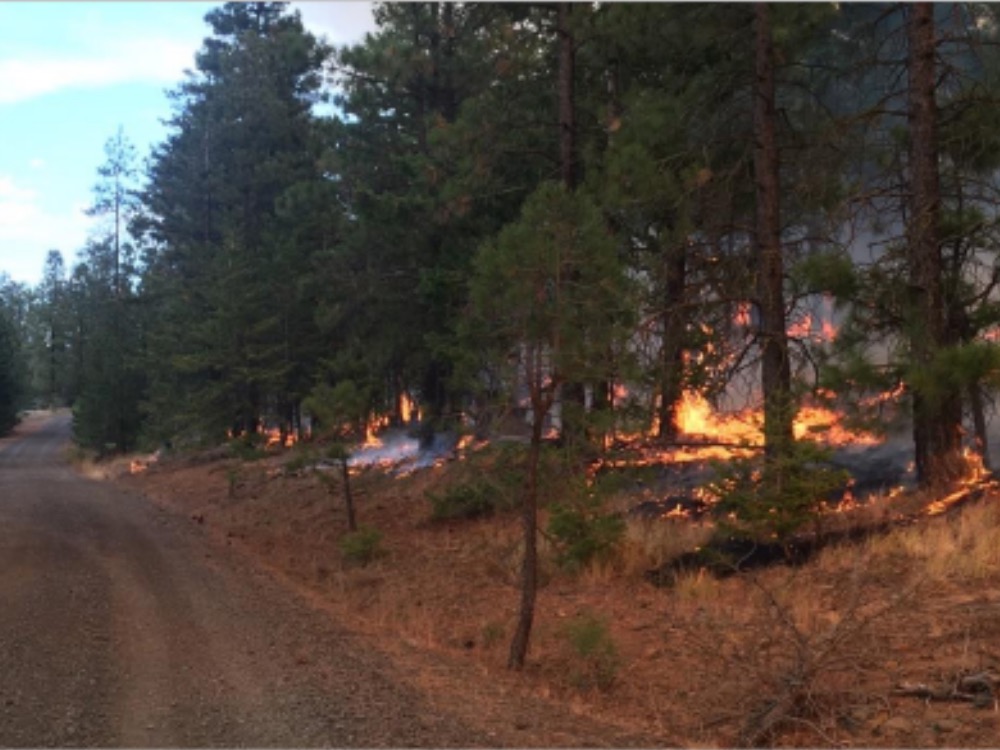
“Fall prescribed burn plans include underburning, which removes accumulated fuels on the forest floor, such as leaves, pine needles, sticks, branches, brush, and fallen trees. We will also be burning piles of debris created from a combination of forest thinning and suppression operations from past wildfires,” said Forest Fire Staff Officer Kyle Cannon.
“These ongoing efforts to restore and improve the resiliency of the forests in and around north central Washington communities are very important,” Cannon said. “Prescribed fire helps reduce the risk of destructive wildfires by reducing and removing hazardous fuel loads near developed areas and restores habitat.”
These prescribed burns are occurring within the Central Washington Initiative Landscape, one of 21 focal landscapes identified within the Forest Service’s Wildfire Crisis Strategy. The implementation of these prescribed burns supports our commitment to creating resilient landscapes and resilient communities as part of these efforts.
Each project follows a prescribed fire burn plan. These burn plans represent many years of analysis and preparation to ensure burn operations meet prescriptive conditions that allow for successful burns that provide multiple resource benefits.
The forest adheres to Washington air quality standards and coordinates with Washington State Department of Natural Resources ahead of burning to ensure conditions are right to minimize the impacts of smoke to our neighbors, cooperators, and surrounding communities. Potential smoke impacts, looking at volume of smoke, direction of spread, and mixing heights, are determined prior to each burn.
Forest visitors and people in nearby communities may see smoke from these prescribed burning operations. Even though smoke from prescribed fire is usually light and usually doesn’t last long, it is important that smoke-sensitive individuals preplan and be prepared. Visit the Environmental Protection Agency’s Smoke Ready toolkit for more information on preparing for impacts of wildfire and prescribed fire smoke.
“The impact of smoke on our communities is always a concern, both from wildfire events as well as planned prescribed fire. The fall prescribed fire season follows summer wildfires and our communities often have had to cope with wildfire smoke that originates both locally as well as regionally. We do our best to limit the negative impacts of high concentrations of smoke during our prescribed fires while balancing the critical need for fuels treatments that will protect our communities from future wildfires,” Cannon added.
An interactive map of the proposed burn areas may be viewed at www.tinyurl.com/harqnw8, and daily updates are recorded and available at 509-966-4040. All Okanogan-Wenatchee National Forest burn projects are weather-dependent and fire specialists will cease burning if objectives are not being met or weather conditions are unfavorable.
The fall burning project areas include:
Methow Valley Ranger District (at total of 3,220 acres of prescribed burning is planned this fall)
- Lost Driveway Unit 15—39 acre underburn located 2.5 miles west of Mazama, WA. Smoke will be visible from Mazama.
- Lost Driveway Unit 10—50 acre underburn located .8 mile west of Mazama, WA. Smoke will be visible from Mazama, WA.
- Lost Driveway Unit 3—42 acre underburn in the Yellow Jacket Sno-Park, west of Mazama. Smoke will be visible from Mazama and Hwy. 20 into Winthrop, WA.
- Lost Driveway Unit 1—65 acre underburn near Riverbend Campground west of Mazama, smoke visible from Mazama and down Hwy. 20 to Winthrop, WA.
- Cub Creek—95 acres of hand piles in the Cub Creek drainage north of Winthrop, WA. Smoke will be visible from Winthrop.
- Benson Creek—448 acres of hand piles in the Benson Creek area east of Carlton, WA. Smoke may be visible from Twisp and Carlton.
- Loup Summit—764 acres of hand piles located 10 miles east of Twisp, WA. Smoke will be visible from Loup Loup Pass.
- Mission—1,520 acres of hand piles in the Libby Creek area west of Carlton, WA. Smoke will be visible from Carlton.
- Upper Methow—197 acres of hand piles west of Mazama. Smoke will be visible from Mazama, WA and the Hwy. 20 corridor.
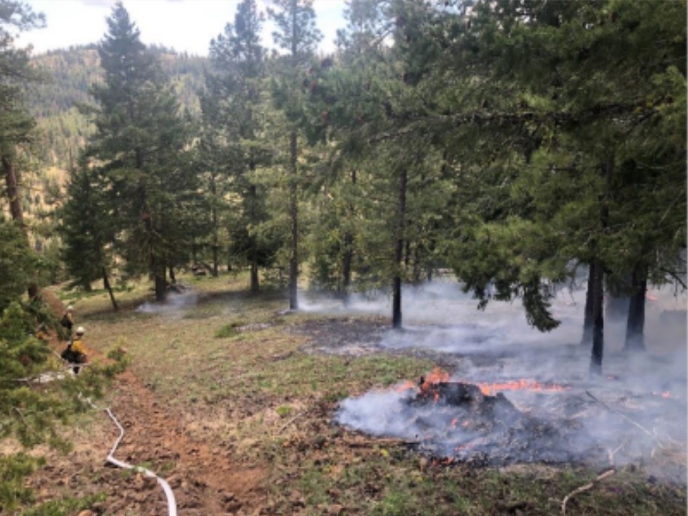
Photo: underburning in the Canteen prescribed burn unit on the Naches Ranger District on May 10, 2023.
Credit: U.S. Forest Service by Jason Emhoff
Chelan Ranger District (a total of 816 acres of prescribed burning is planned this fall)
- Falls Coyote Unit 295 underburn—295 acres in the Falls and Coyote Creek area 12 miles northwest of Manson, WA. Smoke will be visible from Manson and Chelan.
- Falls Coyote pile units 85 and 74 totaling 159 acres in the Falls and Coyote Creek area located 12 miles northwest of Manson, WA. We anticipate minimal smoke impacts.
- Echo Ridge underburn—301 acres in the Echo Ridge area 6 miles northwest of Manson and Chelan, WA. While burning is occurring, trail users may experience some inconveniences such as impacts from smoke, fire personnel and equipment on the roads and trails in the area, and restricted trail access while burning occurs adjacent to trails. Smoke will be visible from Manson and Chelan.
- First Creek pile burning—61 acres in the First Creek drainage approximately 12 miles west of Chelan and 5 miles west of Manson, WA. Minimal smoke impacts are expected.
Entiat Ranger District (a total of 2,503 acres of prescribed burning is planned this fall)
Plans are to burn 16 pile burn units on the Entiat Ranger District in total encompassing 2,503 acres. Smoke will be visible from the communities of Ardenvoir, Entiat, and Chelan but we anticipate the smoke impact will be minimal.
- Bisping units—905 acres in the Mud Creek area, located 3.5 miles northeast of Ardenvoir, WA.
- Forest Johnson units—1,011 acres located 5 miles northeast of Ardenvoir, WA.
- Yellowjacket 35 unit—587 acres in the Tillicum drainage approximately 2 miles southwest of Ardenvoir, WA.
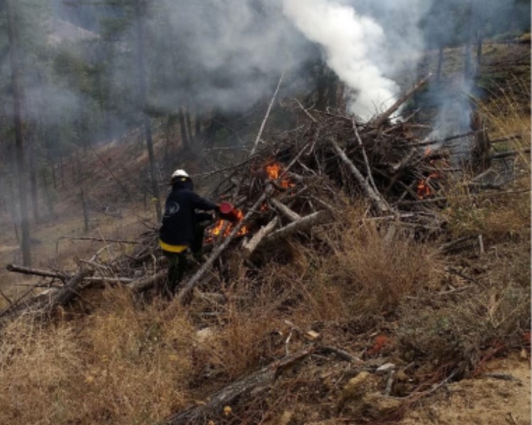
Photo: A firefighter igniting a hand pile of forest debris on the Wenatchee River Ranger District.
Credit: U.S. Forest Service by Jessica Gilmore
Cle Elum Ranger District
- Orion 5 underburn—150 acres on the west side of Hwy. 97, five miles west from the top of Blewett Pass and 17 miles northeast of Cle Elum, WA. Smoke may impact the Hwy. 97 corridor.
Naches Ranger District (a total of 3,500 acres of prescribed burning is planned this fall)
- Canteen underburn—1,500 acres in the Hwy. 410 corridor 15 miles northwest of Naches, WA. Smoke will be visible from Naches and surrounding communities.
- Little Naches pile burning–2,000 acres in the Little Naches area 30 miles northwest of Naches, WA. Smoke will be visible in the Little Naches area.
Wenatchee River Ranger District (a total of 1,940 acres of prescribed burning is planned this fall)
- Beehive Units—Plans are to underburn 700 acres in several different units in the Beehive area, approximately 8 miles southwest of Wenatchee, WA and 12 miles south of Cashmere, WA, starting the first week in October. The project is broken out into several different units so that we can burn larger units as the weather permits, and smaller units when conditions are less favorable. The ignitions portion of the project may last a week or longer depending on weather conditions. Some smoke may be visible in the burn areas for weeks after burns occur. We encourage people to avoid using Forest Service Road 9712 to the Beehive Reservoir area while crews are doing the prescribed burning. Access along this road may be restricted at times while burning operations occur. Please contact the Wenatchee River Ranger District office for information about the intermittent road closure.
- Lower Peshastin Watershed underburn—40 acres as weather and conditions permit in the Lower Peshastin watershed area 5 miles up Blewett Pass. Smoke will be visible from Hwy. 97.
- Pile burning will be occurring along the Blewett Pass Hwy. 97 corridor, in the Martin Ranch area in Number 2 Canyon 5 miles west of Wenatchee, and near Derby Canyon about 4 miles northeast of Peshastin, WA. In total, approximately 1,200 acres of hand pile burning operations will occur in these three locations–100 acres at Martin Ranch, 200 acres at Derby Canyon, and 900 acres along Blewett Pass.
Follow our Facebook and Twitter (X) profiles at https://www.facebook.com/OkaWenNF and https://twitter.com/OkaWenNF . General forest information can be found at https://www.fs.usda.gov/okawen/ .
For more information about these projects, contact the appropriate district office.
- Chelan Ranger District: 509-682-4900
- Cle Elum Ranger District: 509-852-1100
- Entiat Ranger District: 509-784-4700
- Methow Valley Ranger District: 509-996-4000
- Naches Ranger District: 509-653-1401
- Wenatchee River Ranger District: 509-548-2550


