Pioneer Fire Update August 26, 2024
information released
There has been little to no growth of the Pioneer Fire and minimal fire activity over the last week.
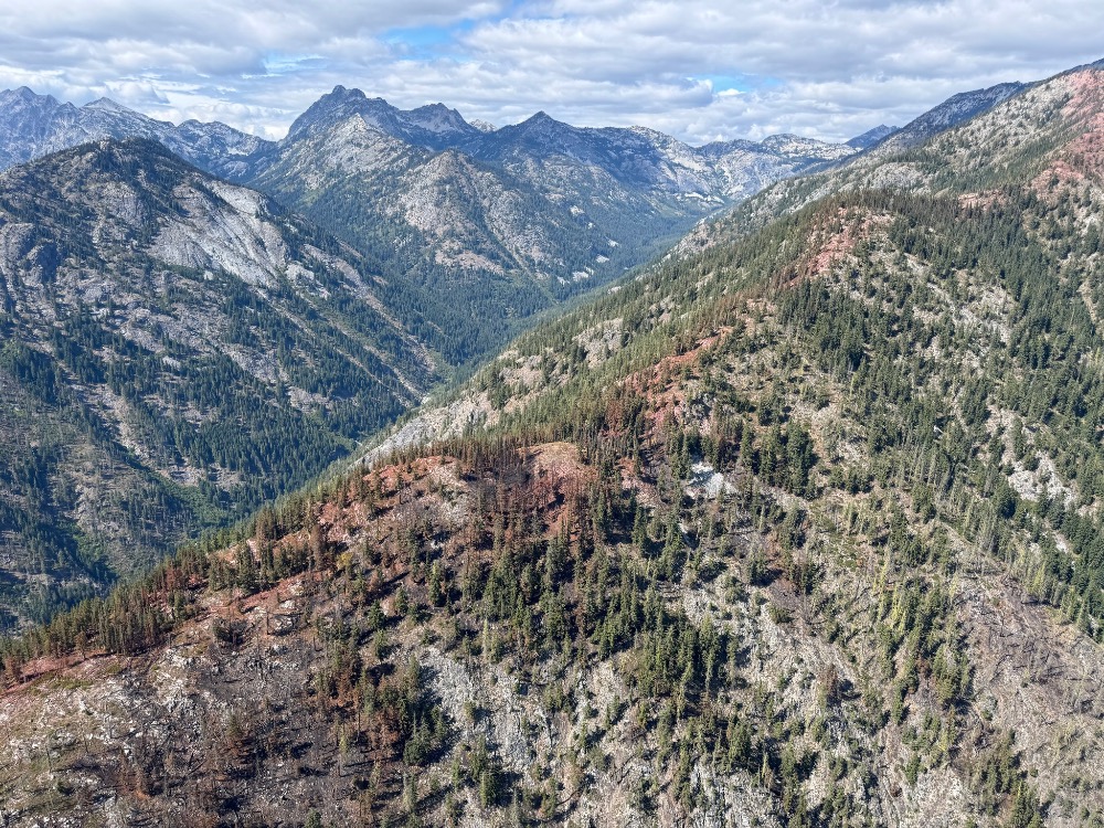
Firefighters patrolling the area yesterday found one small pocket of heat well interior of existing holding features. In the Stehekin area, the Pioneer Fire is still holding below the Boulder Creek retardant check line (see photo above).
Quick Facts for August 26, 2024:
#PioneerFire2024
• 38,735 acres
• 23% contained
• Cause: Under investigation
• 2 crews, 6 helicopters, 7 engines, 17 water tenders, 8 heavy equipment

CURRENT SITUATION: Firefighters conducted on the ground and aerial patrols over the Pioneer Fire today following the last storm system that deposited over an inch of rain over the fire area. One small pocket of heat was identified in the Little Boulder drainage well interior of existing holding features. Resources completed backhaul of excess equipment by boat and aircraft and conducted suppression repair work to stabilize holding features and prevent potential soil erosion. Flights over the Rennie, McAlester and Flat Creek Fires revealed one small pocket of heat on the Flat Creek Fire. All three fires have remained in their existing footprints for the past several days.
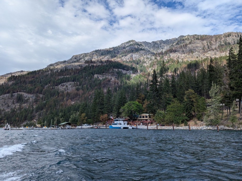
Stehekin is now open to visitors. Many fire-related hazards remain in the area and services may be limited or altered. Additionally, many trails and campgrounds remain closed due to these hazards. Visitors should confirm available services before traveling.
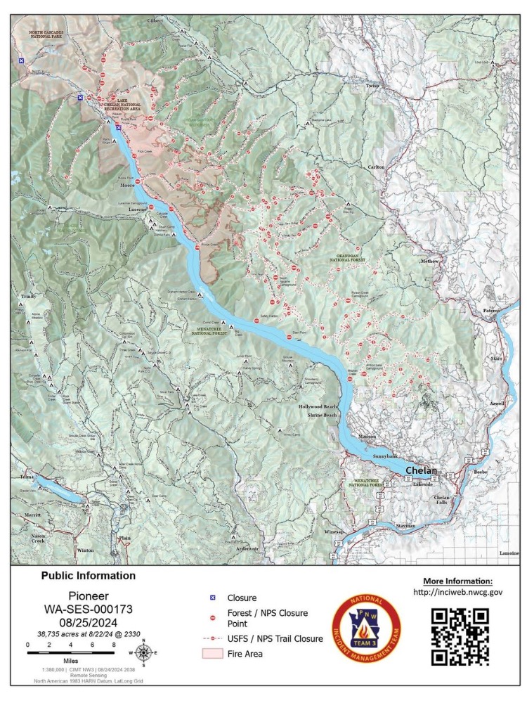
TODAY’S ACTIVITIES: Firefighters are conducting suppression repair on hand line in the Moore Point and Stehekin Landing areas. Crews continue backhauling hose and equipment around Safety Harbor. Firefighters in the Cooper Ridge area are masticating and removing vegetation debris. Resources south of the fire near Manson are working on road repair from fire traffic. As fire activity decreases, excess equipment and resources are being released from the incident. Firefighters remain ready to assist with potential new fire starts.
WEATHER: Partly cloudy skies with increasing winds in the afternoon bringing another weather system into the area along with a chance of precipitation. A warming and drying trend begins Tuesday afternoon.
EVACUATIONS: To view the current evacuation levels, please visit the Chelan County Emergency Management Facebook page at facebook.com/CCSOEM or view the https://chelangis.maps.arcgis.com/apps/instant/media/index.html?appid=ca1e19e4123b4002a9fb176b25434e03/.
CLOSURES: Many trails and campgrounds remain closed. Check the current closures for the North Cascades National Park: https://go.nps.gov/fireclosures and Okanogan-Wenatchee National Forest: https://www.fs.usda.gov/alerts/okawen/alerts-notices before traveling to these areas. Campfires are prohibited. The Pacific Crest Trail is closed in areas across Washington due to multiple wildfires. For more information, please visit: closures.pcta.org/. There is a Temporary Flight Restriction (TFR) in place over the fire: tfr.faa.gov/save_pages/detail_4_2248.html. Unauthorized drone activity is prohibited under the TFR.
To receive fire updates via email, sign up at: https://lp.constantcontactpages.com/sl/PndMhvq
Public Information:
- Facebook: https://www.facebook.com/people/Pioneer-Fire-Information/61560760893080/
- E-mail: 2024.pioneer@firenet.gov
- Phone: 541-861-5808; 8 a.m.-8 p.m. (7 days a week)
- Inciweb: https://inciweb.wildfire.gov/incident-information/wases-pioneer and https://inciweb.wildfire.gov/incident-information/waowf-easy-fire
- Washington Smoke Blog: https://wasmoke.blogspot.com/
- Link Tree: https://linktr.ee/pioneerfirechelan


