
Visitors asked to evacuate immediately; residents asked to prepare to leave
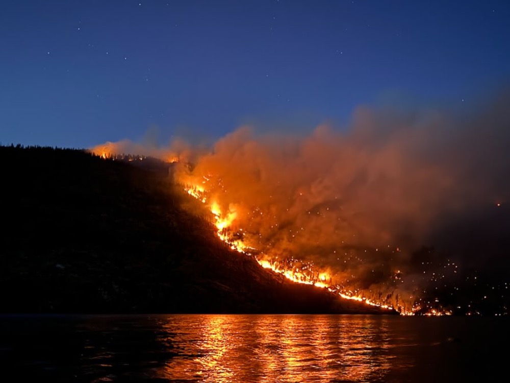
information released; photo by Jenna Rahm
In response to the ongoing Pioneer Fire, Chelan County Emergency Management has issued a Level 2 evacuation notice for the community of Stehekin, from Hazard Creek through the Stehekin Valley, including the Stehekin landing and west to High Bridge.
The Level 2 goes into effect at 8 a.m. Thursday, July 25.
A Level 2 evacuation means no tourism-related visitors will be ferried into Stehekin. The following groups are required to leave Stehekin on Thursday:
- All tourism-related visitors
- All campers and hikers
Emergency Management and the Chelan County Sheriff’s office will be staged in Stehekin. Because of firefighting efforts, it is vital the above groups leave Stehekin under the Level 2 order.
A boat schedule and times for people to be at the landing on Thursday will be posted to the Emergency Management Facebook page and its Active Emergencies webpage.
Parking is extremely limited at the landing; the space is needed for fire equipment and emergency personnel. People are advised to use the recommended parking area at the airfield that has been established for this evacuation. Shuttle buses running along Stehekin Valley Road will provide transport to the landing. Areas of Refuge, with shuttle service, have also been established at the Stehekin Ranch, airfield, Buckner Orchard and Stehekin bakery. Maps are attached.
Emergency Management strongly advises property owners and residents to begin to prepare to leave at a moment’s notice if a Level 3 (Get out now) evacuation notice is necessary. Residents can find fire information on the fire information board at the Stehekin landing. A public Information Officer (PIO) is stationed in Stehekin and is available to answer questions. PIOs visit local businesses daily to provide current updates. A PIO can provide visitors with information to assist with their plans to leave the area.
The Pioneer Fire, which is at 30,667 acres, is burning on the north shore of Lake Chelan. More information about the fire and firefighting efforts is at https://inciweb.wildfire.gov/incident-information/wases-pioneer
Important Links:
Monitor the Chelan County Emergency Incidents Map for evacuation levels:
EM Active Emergencies webpage: https://www.co.chelan.wa.us/emergency-management/pages/active-emergencies


