Revitalized tool would allow 7,000 acres of DNR-managed trust land to be conserved or managed for recreation
information released by Department of Natural Resources
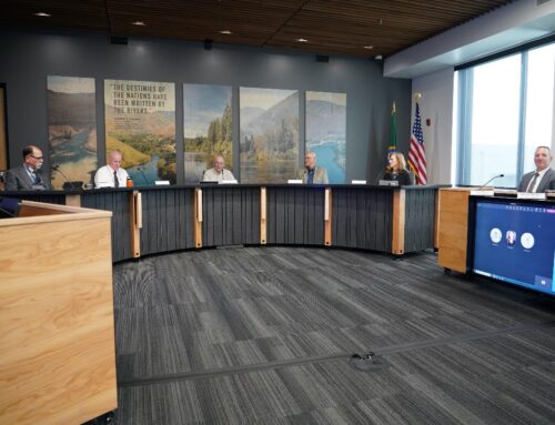
The Washington State Board of Natural Resources approved a priority list of 10 underperforming parcels to be transferred into conservation or recreation management as part of the pilot project to revitalize the Trust Land Transfer tool during its meeting Tuesday morning in Olympia.
The Washington State Department of Natural Resources will submit the ranked list of properties, which come from 10 different counties across the state, to the Office of Financial Management and the Governor’s Office as part of agency requests for the next legislative session. The 7,033 acres of land are proposed to be transferred to public agencies, including DNR’s Natural Areas program, the Washington Department of Fish and Wildlife, Washington State Parks, and county governments. The transfers will require funding from the Legislature before they can be completed.
“We have a responsibility to ensure that Washington state’s public lands are providing the greatest environmental, social, and economic good. The revitalized Trust Land Transfer tool will be a critical device to ensure environmental equity while allowing for more efficient management of state lands for present and future generations,” said Commissioner of Public Lands Hilary Franz, the statewide elected official who oversees DNR. “I am grateful to the many people who have spent considerable time to create a new vision for Trust Land Transfers, balancing ecology and economics while cultivating support from communities and tribes across the state.”
DNR generates more than $250 million each year through the management of trust lands, which are required to generate revenue to support schools, colleges, and critical local services across Washington state. That revenue comes from sustainable forest management, agricultural leases, clean energy leases, commercial real estate leases, and, soon, carbon credits.
The Trust Land Transfer tool is designed to transfer lands that don’t produce expected amounts of revenue and provide important ecological values or public benefits. If funded by the Legislature, DNR will transfer these lands to public agencies for conservation or recreation purposes and then replace them with lands better suited to generate money to support school construction and local governments.
Revitalization of the Trust Land Transfer tool was a major project of the 2021 Trust Land Performance Initiative, which focused on identifying tools to address underperforming land assets. This effort, funded in part by the Legislature, is designed to make the tool more consistent, transparent, repeatable, and effective. The Trust Land Performance Initiative builds upon the findings of DNR’s 2021 Legislature-directed report titled, “Trust Land Performance Assessment Project: Charting a Course for the Future.”
Beneficiaries, tribes, industry, and conservation groups have worked with DNR staff for more than a year to reshape the tool, developing a new framework and creating a pilot project to test it out. One key feature is an improved analysis to determine whether it is in the best interests of the trust beneficiaries to transfer parcels proposed by applicants. In addition, a new advisory committee will score prospective Trust Land Transfer parcels according to five criteria – community involvement and support, ecological values, economic values, public benefits, and tribal support – and then DNR will use these scores to prioritize the proposed transactions. Parcels will be transferred in priority order.
Since 1989, Trust Land Transfers have conserved nearly 126,000 acres, but only about 56,000 acres have been added back through the tool to support funding for K-12 school construction. Past funding has required that 80 percent of the cost of the transfer be delivered directly to beneficiaries, making it impossible to do acre-for-acre replacements of lands moved out of revenue generation status and slowly shrinking the amount of land DNR can manage. DNR is proposing that this requirement be removed and other changes be made to ensure the Department has the funding it needs to purchase productive replacement lands.
DNR is also exploring the expansion of the tool to include State Forestlands, which support local services like hospitals, school districts, and libraries in nearly every western Washington county. To complete the transformation of the Trust Land Transfer tool, DNR will make a group of requests to the Legislature to codify these changes.
Here are more details on each of the 10 parcels included in the package, in ranked order:
Eglon property, Kitsap County: The 707-acre parcel north of Kingston contains 130-year-old forests, wetlands, and salmon-bearing streams, and approximately half of it is not suitable for timber harvest due to buffers protecting clean water and unstable slopes. The parcel is proposed for transfer to Kitsap County to be managed for park purposes.
Devils Lake property, Jefferson County: The 415-acre parcel south of Quilcene contains a rare forested plant community and a mile of Puget Sound shoreline, and about 70 percent of it not suitable for timber harvest due to buffers protecting clean water and unstable slopes. Additionally, there is no road or trail access to the parcel. The parcel is proposed to be transferred to DNR’s Natural Areas program and added to the existing Devils Lake Natural Resources Conservation Area.
Upper Dry Gulch property, Chelan County: The 3,023-acre parcel east of Wenatchee is steep and arid, lacks water rights, and contains 95 percent of all known habitat of the Whited’s milk-vetch, an endangered plant unique to Chelan County. DNR transacted a land exchange for 2,205 of these acres in May 2020 to consolidate the previously fragmented habitat. The parcel is proposed to be transferred to DNR’s Natural Areas program and added to the existing Upper Dry Gulch Natural Area Preserve.
Chapman Lake property, Spokane County: The 542-acre parcel south of Cheney is not suitable for forestry, agriculture, or clean energy development, but a proposed transfer to the Washington Department of Fish and Wildlife would allow that agency to restore fishing access to the lake, which has been lost since the closure of a private resort there in 2011.
Morning Star property, Snohomish County: This 1,071-acre parcel north of Gold Bar contains steep slopes, unstable soils, nonproductive areas, and wildlife habitat areas, and about 80 percent of the parcel is not able to be managed for timber harvest. The parcel is proposed to be transferred to DNR’s Natural Areas program and added to the southwestern edge of the Morning Star Natural Resources Conservation area.
West Tiger property, King County: This 99-acre parcel lacks road access, and about 80 percent of it cannot be harvested due to buffers protecting unstable slopes and water quality. The parcel is proposed to be transferred to DNR’s Natural Areas program and added to the nearby West Tiger Natural Resources Conservation Area.
Lake Spokane Campground property, Stevens County: This 305-acre parcel is a recreation site managed by Washington State Parks through a lease agreement with DNR, with a campground, boat launch access, and parking. The parcel is proposed to be transferred to State Parks to allow that agency to formally add the land to Riverside State Park.
Blakely Island property, San Juan County: The 184-acre parcel on the western edge of Blakely Island is not suitable for timber management because there is important marine shoreline habitat and potential old-growth forest on the site, which also lacks legal road access. The parcel is proposed to be transferred to San Juan County to be managed for parks purposes.
Moses Lake Sand Dunes property, Grant County: The 647-acre parcel south of Moses Lake lacks water rights and legal access. Grant County manages an off-road vehicle recreation site to the north of the parcel, and this parcel is proposed to be transferred to the county for parks purposes.
Rustler’s Gulch property, Pend Oreille County: The 40-acre parcel in the southwest corner of Pend Oreille County is surrounded on all sides by the Rustler’s Gulch unit of the Washington Department of Fish and Wildlife’s Sherman Creek Wildlife Area. This parcel is proposed to be transferred to WDFW to be added to the wildlife area.
Maps, photos, and more information on each of the proposed Trust Land Transfer parcels are available on the Board of Natural Resources webpage.


