Expect Mixed Rain and Snow in lower elevations
Information released
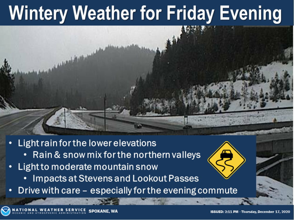
According to the National Weather Service, the next round of precipitation will arrive Friday evening.
Expect low elevation rain, a mix of rain and snow in the northern valleys with more mountain snow. This could impact travel especially over mountain passes including Stevens and Lookout. Drive with care.
Periods of moderate to heavy rain and high mountain snow can be expected across the Inland Northwest this weekend along with milder temperatures and gusty winds. The highest rainfall amounts will be near the crest of the Washington Cascades with two to four inches likely through Sunday, and an additional one to two inches possible for Sunday into Monday.
Snow levels will be rising to around 7,000 feet by Saturday night and remain between 5,000 to 6,000 feet through Sunday before decreasing to around 5,000 feet on Monday. The combination of rain and snowmelt will increase flows on the rivers, creeks and streams along the east slopes of the Cascades with the sharpest rises expected late Saturday into Monday. At this time, no widespread flooding is expected on the main rivers, but minor flood impacts may be seen on the smaller flashy streams and low lying areas with recent snowmelt.
If you live along a creek, stream or river, be aware of the changing conditions and continue to monitor weather and stream flow forecasts.
For current road and weather conditions, call 5-1-1 or visit the National Weather Service or WSDOT websites.


