National Weather Service: Big Changes Arrive Friday with Snow and Gusty Winds
Information and graphics released by the National Weather Service
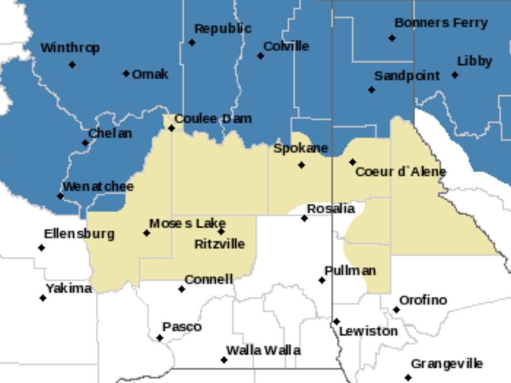
The National Weather Service has issued a Winter Storm Watch for much of North Central and Eastern Washington in anticipation of snowfall and gusting winds Friday morning through Saturday morning.
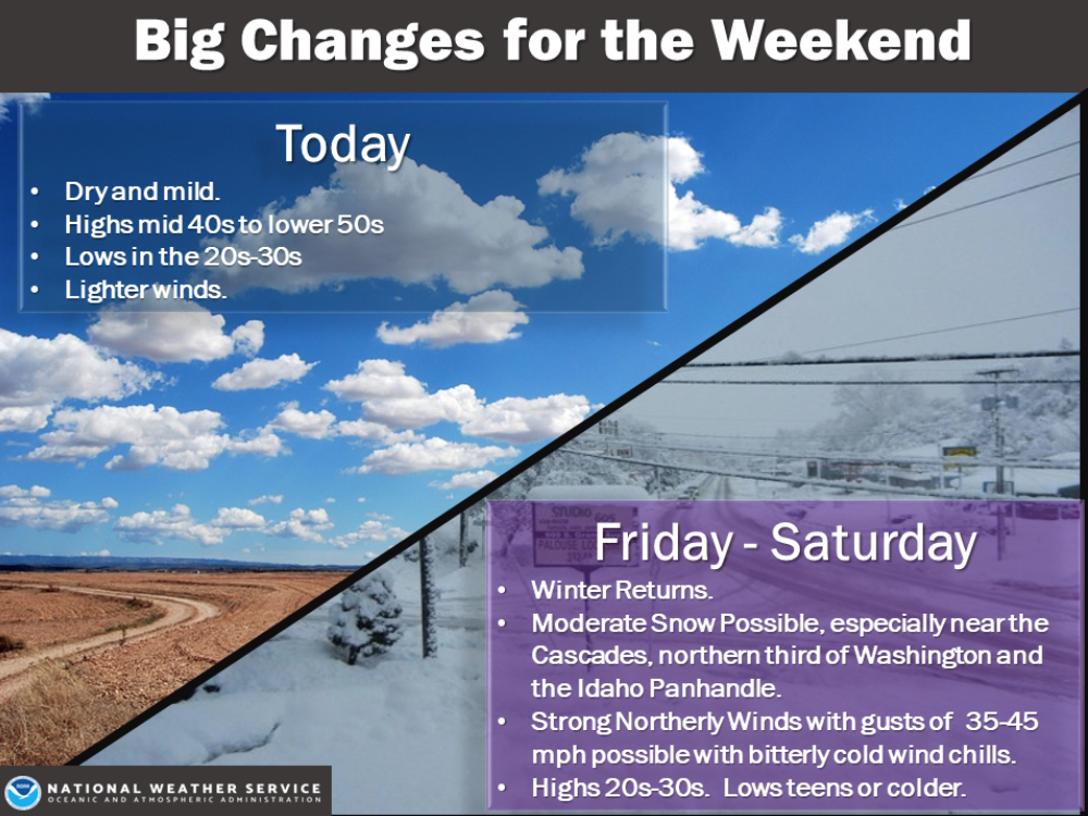
Moderate to locally heavy snow accumulations are possible along the East Slopes of the Cascades into the northern valleys and mountains Friday morning (3/13) through Saturday morning (3/14).
* What, Moderate to Heavy Snow Possible. Areas of Drifting And Blowing Snow. Valley Snow Accumulations of 2 to 5 Inches With Local Amounts Up to 7 Inches Possible. Mountain Snow Accumulations 6 to 12 Inches. winds Could Gust As High As 50 MPH in the North Idaho Panhandle and Columbia Basin.
* Where, Sandpoint, Bonners Ferry, Priest River, Eastport, Schweitzer Mountain Road, Colville, Northport, Deer Park, Chewelah, Newport, Kettle Falls, Springdale – Hunters Road, Orin – Rice Road, Flowery Trail Road, Republic, Inchelium, Wauconda, Chesaw Road, Highway 20 Wauconda Summit, Boulder Creek Road, Sherman Pass, Wenatchee, Chelan, Entiat, Cashmere, Number 1 Canyon, Number 2 Canyon, Pangborn Airport, Omak, Okanogan, Brewster, Bridgeport, Oroville, Nespelem, Disautel Pass, Waterville, Mansfield, and Badger Mountain Road.
* When, from Friday Morning Through Saturday Morning.
* Impacts, Valley Roads May Become Briefly Covered with Light Snow Friday Morning Before Melting or Turning Slushy by Midday. Wintry Travel Conditions will Likely Develop Friday Evening And Persist Into Saturday Morning As Temperatures Fall and Snow Increases Substantially.
The Wintry Travel Conditions Could Be Accompanied by Areas of Blowing and Drifting Snow Which Will Further Reduce the Visibility. The winds Could Result in Downed Tree Branches Friday Night Into Saturday As Well As Wind Chills in the Single Digits Below Zero by Saturday Morning.
Monitor the NWS Latest Forecasts for Updates on this Situation and check Washington State DOT for current pass conditions.
