National Weather Service Predicts Gusty Winds and High Elevation Snow
Information and graphs released by NWS
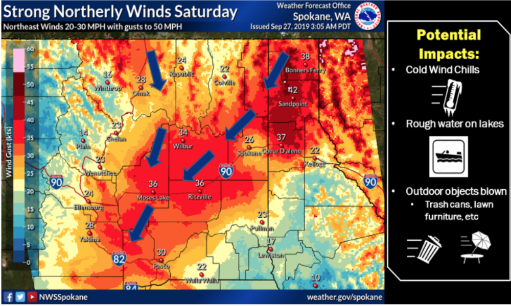
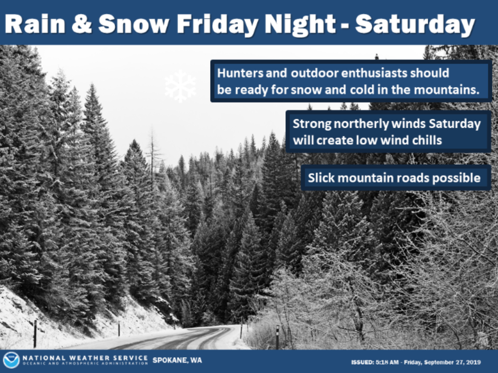
It’s not even October and already upper elevations could see winter driving conditions this week. The National Weather Service has issued a hazardous weather outlook which includes portions of Central and North Central Washington. The forecast Friday and Saturday calls for northerly wind gusts as high as 50 mph, while Saturday into mid-next week also includes a frost and snow watch in the upper elevations.
Hazardous Weather Outlook – National Weather Service Spokane WA
Friday, September 27, 2019
This Hazardous Weather Outlook is for portions of North Idaho…Central Washington…East Central Washington…North Central Washington…Northeast Washington and Southeast Washington.
DAY ONE…TODAY AND TONIGHT
Winds will increase from the northeast down the Highway 95 corridor overnight.
DAYS TWO THROUGH SEVEN…SATURDAY THROUGH THURSDAY
Raw and windy northeast winds will blow across much of north Idaho and eastern WA Saturday through Sunday. Blowing dust is a growing
concern if we do not receive any appreciable precipitation before Saturday across portions of the Columbia Basin. Unsecured items could be blown around. Tree limbs could break and a few power outages may result.
The unseasonably cold weather system will bring a chance of snow over higher terrain Saturday through Sunday. In the valleys areas of frost are possible each morning this weekend and into early next week. Winter driving conditions are expected across the mountains this weekend.
