
Heavy Snow Expected Overnight
information released from National Weather Service
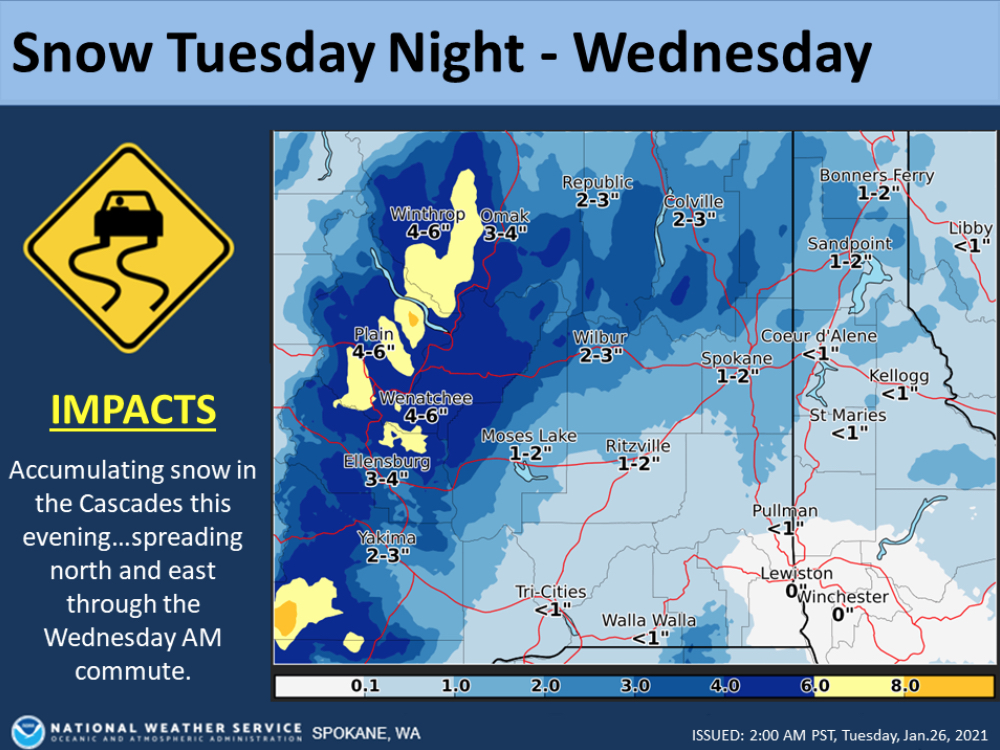
The National Weather Service has issued a Winter Storm Warning for North Central Washington from 10:00 p.m. Tuesday night through 10:00 a.m. Wednesday.
Heavy snow is expected with total accumulations of 3 – 5 inches. The following areas may be impacted: Wenatchee Area-Waterville Plateau- Including Number 1 Canyon, Waterville, Badger Mountain Road, Cashmere, Mansfield, Pangborn Airport, Chelan, Number 2 Canyon, Entiat, and Wenatchee.
Travelers are urged to use caution. Current road conditions are available by calling 5-1-1.
The full advisory is below:
* WHAT…Heavy snow expected. Total snow accumulations of 3 to 5 inches.
* WHERE…Number 1 Canyon, Waterville, Badger Mountain Road, Cashmere, Mansfield, Pangborn Airport, Chelan, Number 2 Canyon, Entiat, and Wenatchee.
* WHEN…From 10 PM this evening to 10 AM PST Wednesday.
* IMPACTS…Plan on slippery road conditions. The hazardous conditions could impact the Wednesday morning commute.
PRECAUTIONARY/PREPAREDNESS ACTIONS…
If you must travel, keep an extra flashlight, food, and water in your vehicle in case of an emergency.
The latest road conditions for the state you are calling from can be obtained by calling 5 1 1.


