
Tuesday night through Wednesday evening
information released by the National Weather Service
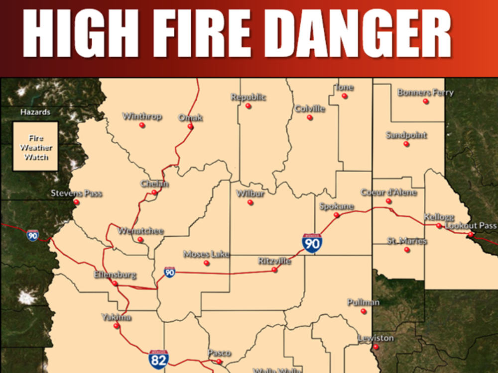
A fire weather watch has been issued for late Tuesday night through Wednesday evening. Morning lightning followed by afternoon gusty winds will create high fire danger. Any fire starts from lightning will have the potential for rapid spread with the afternoon gusty winds.
Warning Issued: Wednesday evening for thunderstorms followed by wind and low relative humidity for east slopes of the Cascades into the Columbia Basin, Palouse and Spokane area.
* Affected Area: Fire Weather Zone 673 East Washington Northern Columbia Basin (Zone 673), Fire Weather Zone 674 East Washington Palouse and Spokane Area (Zone 674), Fire Weather Zone 676 East Washington South Central Cascade Valleys (Zone 676), Fire Weather Zone 677 East Washington Central Cascade Valleys (Zone 677), Fire Weather Zone 680 East Washington South Central Cascade Mountains (Zone 680) and Fire Weather Zone 682 East Washington Central Cascade Mountains (Zone 682).
* Thunderstorms: Elevated early morning dry thunderstorms will be possible.
* Winds: West 10 to 20 mph with gusts up to 30 mph.
* Relative Humidities: 14 to 25 percent in the valleys and 25 to 47 percent over the higher terrain.
* Impacts: New fire starts with rapid spread possible from gusty winds.
Precautionary/Preparedness Actions: A Fire Weather Watch means that critical fire weather conditions are forecast to occur. Visit the NWS website for later forecasts and possible Red Flag Warnings.


