
Winter Storm Warning Issued – Colder Temperatures anticipated through Tuesday
Information and graphs compiled from NWS, WSDOT and AAA
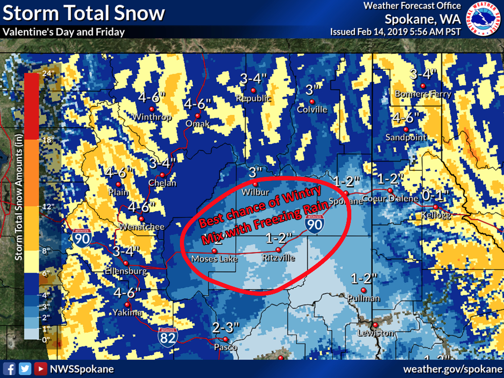
The National Weather Service has posted another Winter Storm Warning from Thursday morning through 4:00 a.m. Friday. Snowfall with accumulations of 5-7″ is expected, which could create hazardous driving conditions throughout North Central Washington.
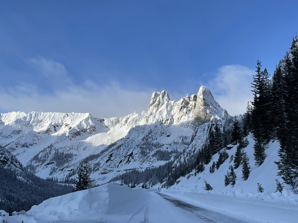
Travel Impacts Vary. At times Blewett Pass, Stevens Pass and Snoqualmie Pass, as well as regional state and local highways, have all experienced delays, limited access and on occasion closures.
Emergency management officials encourage travelers to remain at home whenever possible, and to prepare for winter driving conditions if travel is unavoidable.
Current road closures and conditions can be found at the WSDOT website. Current mountain pass conditions are also available online.
AAA suggests keeping these items in your vehicle to handle common winter driving-related tasks, such as cleaning off your windshield, as well as any supplies you might need in an emergency.
- Snow shovel, broom, and ice scraper.
- Abrasive material such as sand or kitty litter, in case your vehicle gets stuck in the snow.
- Jumper cables, flashlight, and warning devices such as flares and emergency markers.
- Blankets for protection from the cold.
- A cell phone with charger, water, food, and any necessary medicine (for longer trips or when driving in lightly populated areas).

The National Weather Service blog predicts cold weather through the early part of next week.
After this system goes through we are in store for another blast of cold air from the north. This blast will result from the buckling of the upper level jet stream which will put strong ridging over Alaska and a shot of cold air arriving from the Yukon. It is expected to arrive sometime on late Sunday or Monday. So how cold will it get? Perhaps not as cold as the last blast, but still very cold for this time of year with temperatures almost 15-20°F colder than normal.
Here are the anticipated highs for next Monday and lows into Tuesday.
Monday Highs

Tuesday Lows


