
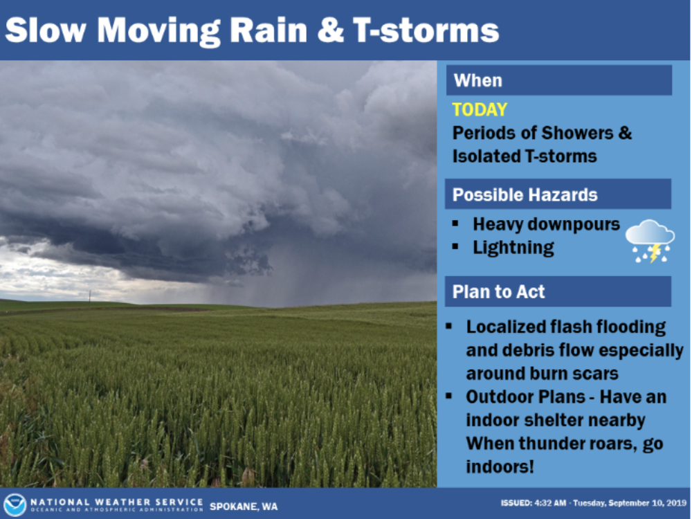
Localized Heavy Rainfall Possible Today
Information released by the National Weather Service – Spokane
A Flash Flood Watch has been issued by the National Weather Service throughout portions of North Central Washington for Tuesday afternoon into the night.
Slow moving thunderstorms this afternoon will be capable of producing torrential downpours leading to flash flooding and debris flows, especially near burn scars. The main areas of concern will be from the Waterville Plateau north and west into the Cascades. Over the last few days, some of these areas have received upwards of 1 to 2 inches of rainfall.
Chelan-Douglas-Okanogan Counties: Including the cities of Wenatchee, Leavenworth, Cashmere, Entiat, Chelan, Manson, Plain, East Wenatchee, Bridgeport, Waterville, Douglas, Omak, Okanogan, Brewster, Oroville, Mazama, Winthrop, Methow, Twisp, and Conconully
5:32 AM PDT Tue Sep 10 2019
…FLASH FLOOD WATCH IN EFFECT FROM 11 AM PDT THIS MORNING THROUGH THIS EVENING…
The National Weather Service in Spokane has issued a
* Flash Flood Watch for a portion of North Central Washington, including the following counties, Chelan, Douglas, and Okanogan.
* From 11 AM PDT this morning through this evening
* Showers with light to moderate rainfall will move through this morning. Showers and thunderstorms will redevelop this afternoon and wane in the evening. Heavy rain in short periods of time will be possible, which will lead to flash flooding and debris flow concerns.
* The main concerns will be the burn scars as well as deep canyons around Wenatchee, Entiat, up Lake Chelan, along Highway 97 and the Methow Valley. Mud slides and debris flows are possible. Sections of Highway 2 across the Waterville Plateau could also be impacted near recently worked fields and near drainages.
PRECAUTIONARY/PREPAREDNESS ACTIONS…
A Flash Flood Watch means that conditions may develop that lead to flash flooding. Flash flooding is a very dangerous situation.
You should monitor later forecasts and be prepared to take action should Flash Flood Warnings be issued.


